
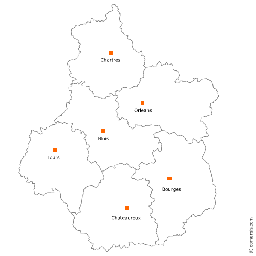
Exploitation forestière et sylviculture en région Centre-Val-de-Loire
512 exploitations forestières sont référencés sur la région Centre-Val-de-Loire
Vous recherchez un exploitant forestier en Centre-Val-de-Loire ?
La région Centre-Val-de-Loire représente 6% des exploitations forestières de France.
C'est le département du Loir-et-Cher qui compte le plus d'exploitations forestières en Centre-Val-de-Loire.
C'est le département du Loir-et-Cher qui compte le plus d'exploitations forestières en Centre-Val-de-Loire.
Exploitation forestière et sylviculture dans le Cher (18)
Secteur de Bourges
Indice d'implantation
| Commune | Nb Pro | Habitants | Distance | |
|---|---|---|---|---|
| Bourges - 18000 | 5 | 67189 | 0,0 | km |
| la Chapelle-Saint-Ursin - 18570 | 1 | 3331 | 6,0 | km |
| Trouy - 18570 | 1 | 3894 | 8,6 | km |
| Vasselay - 18110 | 1 | 1278 | 8,6 | km |
| Berry-Bouy - 18500 | 1 | 1187 | 8,7 | km |
| Moulins-sur-Yèvre - 18390 | 1 | 801 | 9,1 | km |
| Saint-Éloy-de-Gy - 18110 | 1 | 1547 | 9,2 | km |
| Sainte-Thorette - 18500 | 1 | 467 | 15,0 | km |
| Quantilly - 18110 | 1 | 449 | 16,5 | km |
| Allogny - 18110 | 1 | 1025 | 17,2 | km |
| Aubinges - 18220 | 1 | 334 | 21,1 | km |
| Méreau - 18120 | 2 | 2537 | 27,8 | km |
| Charentonnay - 18140 | 1 | 303 | 36,9 | km |
| Saint-Hilaire-de-Gondilly - 18320 | 3 | 177 | 37,4 | km |
| Sancergues - 18140 | 1 | 687 | 40,5 | km |
| Saint-Martin-des-Champs - 18140 | 1 | 308 | 41,0 | km |
Secteur d'Aubigny-sur-Nère
Indice d'implantation
| Commune | Nb Pro | Habitants | Distance | |
|---|---|---|---|---|
| Aubigny-sur-Nère - 18700 | 1 | 5582 | 0,0 | km |
| Oizon - 18700 | 2 | 706 | 6,0 | km |
| Argent-sur-Sauldre - 18410 | 1 | 2130 | 8,0 | km |
| Blancafort - 18410 | 1 | 1116 | 8,3 | km |
| Ménétréol-sur-Sauldre - 18700 | 3 | 228 | 10,9 | km |
| Presly - 18380 | 1 | 235 | 12,8 | km |
| Clémont - 18410 | 1 | 717 | 13,3 | km |
| Villegenon - 18260 | 1 | 226 | 14,3 | km |
| Brinon-sur-Sauldre - 18410 | 1 | 1008 | 16,3 | km |
| Ivoy-le-Pré - 18380 | 2 | 840 | 16,5 | km |
| Méry-ès-Bois - 18380 | 2 | 586 | 20,4 | km |
| Henrichemont - 18250 | 1 | 1806 | 21,8 | km |
| Sens-Beaujeu - 18300 | 1 | 413 | 27,1 | km |
| Neuilly-en-Sancerre - 18250 | 1 | 235 | 28,0 | km |
| Savigny-en-Sancerre - 18240 | 1 | 1032 | 28,5 | km |
| Neuvy-Deux-Clochers - 18250 | 1 | 300 | 30,7 | km |
| Léré - 18240 | 1 | 1139 | 32,6 | km |
Secteur de Saint-Amand-Montrond
Indice d'implantation
| Commune | Nb Pro | Habitants | Distance | |
|---|---|---|---|---|
| Saint-Amand-Montrond - 18200 | 1 | 10238 | 0,0 | km |
| Orval - 18200 | 1 | 1882 | 1,8 | km |
| Meillant - 18200 | 1 | 660 | 5,9 | km |
| la Celle - 18200 | 1 | 348 | 6,2 | km |
| Saint-Pierre-les-Étieux - 18210 | 1 | 717 | 9,0 | km |
| Charenton-du-Cher - 18210 | 1 | 1095 | 10,5 | km |
| Loye-sur-Arnon - 18170 | 1 | 307 | 12,3 | km |
| le Châtelet - 18170 | 1 | 1068 | 19,5 | km |
| Châteauneuf-sur-Cher - 18190 | 1 | 1474 | 19,9 | km |
| Saint-Hilaire-en-Lignières - 18160 | 1 | 521 | 25,1 | km |
| Saint-Baudel - 18160 | 1 | 254 | 25,7 | km |
| Augy-sur-Aubois - 18600 | 1 | 296 | 26,7 | km |
| Givardon - 18600 | 1 | 303 | 26,8 | km |
| Sancoins - 18600 | 2 | 3202 | 33,8 | km |
| Grossouvre - 18600 | 1 | 288 | 37,0 | km |
| la Chapelle-Hugon - 18150 | 1 | 399 | 38,8 | km |
| la Guerche-sur-l'Aubois - 18150 | 3 | 3322 | 42,1 | km |
| Neuvy-le-Barrois - 18600 | 1 | 159 | 43,4 | km |
Exploitation forestière et sylviculture dans l'Indre (36)
Secteur de Châteauroux
Indice d'implantation
| Commune | Nb Pro | Habitants | Distance | |
|---|---|---|---|---|
| Châteauroux - 36000 | 5 | 45209 | 0,0 | km |
| le Poinçonnet - 36330 | 2 | 5808 | 5,6 | km |
| Diors - 36130 | 1 | 763 | 10,1 | km |
| Niherne - 36250 | 1 | 1545 | 10,4 | km |
| Ardentes - 36120 | 2 | 3859 | 12,9 | km |
| Arthon - 36330 | 1 | 1220 | 13,0 | km |
| Luant - 36350 | 1 | 1469 | 13,8 | km |
| Sassierges-Saint-Germain - 36120 | 1 | 486 | 15,6 | km |
| Jeu-les-Bois - 36120 | 1 | 379 | 17,1 | km |
| Levroux - 36110 | 1 | 3 | 19,7 | km |
| Buxières-d'Aillac - 36230 | 1 | 246 | 19,8 | km |
| Mers-sur-Indre - 36230 | 1 | 664 | 21,9 | km |
| Buzançais - 36500 | 2 | 4468 | 22,6 | km |
| Bouges-le-Château - 36110 | 1 | 280 | 25,7 | km |
| Pellevoisin - 36180 | 1 | 830 | 28,7 | km |
| Cluis - 36340 | 1 | 1006 | 30,0 | km |
| Saint-Genou - 36500 | 1 | 997 | 30,3 | km |
| Arpheuilles - 36700 | 1 | 225 | 33,5 | km |
| Crevant - 36140 | 1 | 724 | 40,8 | km |
| Lourdoueix-Saint-Michel - 36140 | 1 | 332 | 43,0 | km |
| Feusines - 36160 | 1 | 208 | 44,5 | km |
Secteur de Blanc
Indice d'implantation
| Commune | Nb Pro | Habitants | Distance | |
|---|---|---|---|---|
| le Blanc - 36300 | 2 | 6721 | 0,0 | km |
| Ruffec - 36300 | 1 | 614 | 8,4 | km |
| Chalais - 36370 | 1 | 159 | 15,2 | km |
| Migné - 36800 | 4 | 287 | 21,5 | km |
| Azay-le-Ferron - 36290 | 1 | 860 | 24,1 | km |
| Rivarennes - 36800 | 1 | 591 | 24,8 | km |
| Obterre - 36290 | 1 | 249 | 31,2 | km |
| Chazelet - 36170 | 1 | 118 | 32,3 | km |
| Châtillon-sur-Indre - 36700 | 1 | 2706 | 40,1 | km |
| Saint-Cyran-du-Jambot - 36700 | 1 | 227 | 42,8 | km |
| Fléré-la-Rivière - 36700 | 1 | 571 | 42,9 | km |
Secteur d'Issoudun
Indice d'implantation
| Commune | Nb Pro | Habitants | Distance | |
|---|---|---|---|---|
| Issoudun - 36100 | 0 | 12420 | 0,0 | km |
| Thizay - 36100 | 1 | 249 | 8,1 | km |
| Migny - 36260 | 1 | 123 | 10,4 | km |
| Diou - 36260 | 1 | 245 | 11,4 | km |
| Brives - 36100 | 1 | 273 | 11,9 | km |
| Chezal-Benoît - 18160 | 1 | 930 | 16,6 | km |
| Ambrault - 36120 | 2 | 931 | 18,1 | km |
| Vicq-Exemplet - 36400 | 1 | 322 | 37,4 | km |
| Valençay - 36600 | 1 | 2575 | 39,7 | km |
Exploitation forestière et sylviculture en Indre-et-Loire (37)
Secteur de Tours
Indice d'implantation
| Commune | Nb Pro | Habitants | Distance | |
|---|---|---|---|---|
| Tours - 37000 | 4 | 134803 | 0,0 | km |
| Saint-Cyr-sur-Loire - 37540 | 1 | 16239 | 1,8 | km |
| Saint-Avertin - 37550 | 1 | 14893 | 4,5 | km |
| Joué-lès-Tours - 37300 | 3 | 37703 | 4,9 | km |
| Rochecorbon - 37210 | 1 | 3193 | 6,0 | km |
| Chambray-lès-Tours - 37170 | 2 | 10881 | 6,5 | km |
| Luynes - 37230 | 2 | 5207 | 9,7 | km |
| Cerelles - 37390 | 1 | 1216 | 11,9 | km |
| Saint-Étienne-de-Chigny - 37230 | 1 | 1461 | 12,9 | km |
| Semblançay - 37360 | 1 | 2128 | 14,1 | km |
| Neuillé-Pont-Pierre - 37360 | 1 | 1916 | 20,0 | km |
| Sonzay - 37360 | 2 | 1381 | 22,3 | km |
| Marray - 37370 | 1 | 434 | 25,6 | km |
| Saint-Paterne-Racan - 37370 | 1 | 1654 | 27,7 | km |
| Saint-Christophe-sur-le-Nais - 37370 | 1 | 1095 | 29,4 | km |
| Chemillé-sur-Dême - 37370 | 1 | 699 | 29,6 | km |
| les Hermites - 37110 | 1 | 591 | 30,7 | km |
Secteur de Langeais
Indice d'implantation
| Commune | Nb Pro | Habitants | Distance | |
|---|---|---|---|---|
| Langeais - 37130 | 2 | 4248 | 0,0 | km |
| Cléré-les-Pins - 37340 | 3 | 1401 | 11,1 | km |
| Avrillé-les-Ponceaux - 37340 | 3 | 473 | 11,7 | km |
| Hommes - 37340 | 2 | 895 | 13,9 | km |
| Restigné - 37140 | 1 | 1208 | 14,1 | km |
| Ambillou - 37340 | 2 | 1853 | 14,2 | km |
| Pernay - 37230 | 1 | 1208 | 14,7 | km |
| Gizeux - 37340 | 2 | 408 | 17,6 | km |
| Channay-sur-Lathan - 37330 | 1 | 831 | 20,2 | km |
| Marcilly-sur-Maulne - 37330 | 1 | 231 | 27,7 | km |
| Villiers-au-Bouin - 37330 | 2 | 770 | 28,5 | km |
Secteur de Loches
Indice d'implantation
| Commune | Nb Pro | Habitants | Distance | |
|---|---|---|---|---|
| Loches - 37600 | 0 | 6343 | 0,0 | km |
| Genillé - 37460 | 2 | 1591 | 9,9 | km |
| Saint-Hippolyte - 37600 | 2 | 619 | 11,2 | km |
| Chemillé-sur-Indrois - 37460 | 1 | 212 | 13,5 | km |
| Luzillé - 37150 | 1 | 923 | 15,6 | km |
| Montrésor - 37460 | 1 | 345 | 16,0 | km |
| Betz-le-Château - 37600 | 1 | 573 | 16,2 | km |
| Beaumont-Village - 37460 | 1 | 280 | 17,0 | km |
| Villeloin-Coulangé - 37460 | 1 | 644 | 17,4 | km |
| Orbigny - 37460 | 2 | 756 | 20,3 | km |
| Céré-la-Ronde - 37460 | 1 | 452 | 20,8 | km |
| Sepmes - 37800 | 1 | 660 | 25,4 | km |
| le Grand-Pressigny - 37350 | 1 | 957 | 27,4 | km |
| Marcé-sur-Esves - 37160 | 1 | 242 | 28,1 | km |
| Descartes - 37160 | 1 | 3689 | 28,2 | km |
| Boussay - 37290 | 1 | 267 | 32,9 | km |
| Bossay-sur-Claise - 37290 | 1 | 781 | 33,2 | km |
| Barrou - 37350 | 1 | 526 | 33,7 | km |
Secteur de Monts
Indice d'implantation
| Commune | Nb Pro | Habitants | Distance | |
|---|---|---|---|---|
| Monts - 37260 | 0 | 7471 | 0,0 | km |
| Artannes-sur-Indre - 37260 | 1 | 2534 | 1,9 | km |
| Sorigny - 37250 | 1 | 2422 | 6,5 | km |
| Veigné - 37250 | 1 | 6098 | 8,6 | km |
| Esvres - 37320 | 1 | 5181 | 12,1 | km |
| Azay-le-Rideau - 37190 | 1 | 3414 | 12,1 | km |
| Vallères - 37190 | 1 | 1150 | 12,1 | km |
| Saint-Branchs - 37320 | 1 | 2588 | 12,3 | km |
| Cheillé - 37190 | 1 | 1759 | 16,6 | km |
| Sainte-Maure-de-Touraine - 37800 | 1 | 4290 | 18,2 | km |
| Pouzay - 37800 | 1 | 835 | 22,7 | km |
| Nouâtre - 37800 | 1 | 847 | 25,7 | km |
Secteur de Chinon
Indice d'implantation
| Commune | Nb Pro | Habitants | Distance | |
|---|---|---|---|---|
| Chinon - 37500 | 1 | 8044 | 0,0 | km |
| Ligré - 37500 | 1 | 1064 | 6,6 | km |
| Cravant-les-Côteaux - 37500 | 2 | 715 | 7,6 | km |
| Thizay - 37500 | 1 | 283 | 7,8 | km |
| Lémeré - 37120 | 1 | 485 | 11,6 | km |
| Chaveignes - 37120 | 1 | 564 | 16,5 | km |
| Razines - 37120 | 1 | 244 | 23,7 | km |
| Antogny-le-Tillac - 37800 | 1 | 517 | 33,0 | km |
Secteur d'Amboise
Indice d'implantation
| Commune | Nb Pro | Habitants | Distance | |
|---|---|---|---|---|
| Amboise - 37400 | 1 | 13246 | 0,0 | km |
| Nazelles-Négron - 37530 | 1 | 3575 | 3,6 | km |
| Saint-Ouen-les-Vignes - 37530 | 1 | 1022 | 6,7 | km |
| la Croix-en-Touraine - 37150 | 1 | 2156 | 7,6 | km |
| Neuillé-le-Lierre - 37380 | 1 | 817 | 13,2 | km |
Secteur de Montlouis-sur-Loire
Indice d'implantation
| Commune | Nb Pro | Habitants | Distance | |
|---|---|---|---|---|
| Montlouis-sur-Loire - 37270 | 0 | 10787 | 0,0 | km |
| Azay-sur-Cher - 37270 | 1 | 3037 | 4,3 | km |
| Monnaie - 37380 | 1 | 4206 | 13,4 | km |
Exploitation forestière et sylviculture dans le Loir-et-Cher (41)
Secteur de Blois
Indice d'implantation
| Commune | Nb Pro | Habitants | Distance | |
|---|---|---|---|---|
| Blois - 41000 | 20 | 45539 | 0,0 | km |
| Vineuil - 41350 | 1 | 7508 | 3,8 | km |
| Villebarou - 41000 | 1 | 2529 | 3,8 | km |
| Chailles - 41120 | 1 | 2574 | 5,3 | km |
| Saint-Claude-de-Diray - 41350 | 1 | 1719 | 7,3 | km |
| Huisseau-sur-Cosson - 41350 | 1 | 2310 | 9,4 | km |
| Chouzy-sur-Cisse - 41150 | 1 | 1962 | 9,7 | km |
| Chitenay - 41120 | 2 | 1044 | 10,8 | km |
| Cour-Cheverny - 41700 | 1 | 2750 | 13,1 | km |
| Champigny-en-Beauce - 41330 | 1 | 592 | 14,6 | km |
| Onzain - 41150 | 2 | 3477 | 15,2 | km |
| Fresnes - 41700 | 1 | 1136 | 18,3 | km |
| Fontaines-en-Sologne - 41250 | 1 | 637 | 18,9 | km |
| Contres - 41700 | 1 | 6 | 20,4 | km |
| Pontlevoy - 41400 | 1 | 1513 | 22,8 | km |
| Thésée - 41140 | 1 | 1177 | 29,2 | km |
| Montrichard - 41400 | 2 | 3995 | 29,2 | km |
Secteur de Salbris
Indice d'implantation
| Commune | Nb Pro | Habitants | Distance | |
|---|---|---|---|---|
| Salbris - 41300 | 10 | 5509 | 0,0 | km |
| Souesmes - 41300 | 4 | 1124 | 10,2 | km |
| Pierrefitte-sur-Sauldre - 41300 | 4 | 832 | 12,3 | km |
| Theillay - 41300 | 7 | 1319 | 12,4 | km |
| Nouan-le-Fuzelier - 41600 | 5 | 2356 | 12,6 | km |
| Saint-Viâtre - 41210 | 1 | 1285 | 14,2 | km |
| Marcilly-en-Gault - 41210 | 1 | 760 | 14,3 | km |
| Lamotte-Beuvron - 41600 | 2 | 4798 | 19,8 | km |
| Chaumont-sur-Tharonne - 41600 | 1 | 1121 | 23,7 | km |
| Vouzon - 41600 | 2 | 1500 | 24,7 | km |
Secteur de Romorantin-Lanthenay
Indice d'implantation
| Commune | Nb Pro | Habitants | Distance | |
|---|---|---|---|---|
| Romorantin-Lanthenay - 41200 | 19 | 16891 | 0,0 | km |
| Villeherviers - 41200 | 1 | 482 | 3,9 | km |
| Pruniers-en-Sologne - 41200 | 1 | 2374 | 7,2 | km |
| Veilleins - 41230 | 1 | 155 | 8,8 | km |
| Lassay-sur-Croisne - 41230 | 1 | 252 | 9,4 | km |
| Gy-en-Sologne - 41230 | 3 | 510 | 12,5 | km |
| Maray - 41320 | 1 | 232 | 16,5 | km |
| Selles-sur-Cher - 41130 | 1 | 4621 | 17,1 | km |
| Neung-sur-Beuvron - 41210 | 1 | 1230 | 19,8 | km |
| Chémery - 41700 | 1 | 979 | 20,2 | km |
| Châtillon-sur-Cher - 41130 | 2 | 1731 | 21,3 | km |
| Méhers - 41140 | 1 | 353 | 22,1 | km |
| Noyers-sur-Cher - 41140 | 1 | 2773 | 27,8 | km |
Secteur de Mer
Indice d'implantation
| Commune | Nb Pro | Habitants | Distance | |
|---|---|---|---|---|
| Mer - 41500 | 3 | 6200 | 0,0 | km |
| Muides-sur-Loire - 41500 | 1 | 1336 | 4,8 | km |
| la Chapelle-Saint-Martin-en-Plaine - 41500 | 1 | 730 | 6,4 | km |
| Montlivault - 41350 | 1 | 1356 | 8,6 | km |
| Crouy-sur-Cosson - 41220 | 1 | 502 | 10,2 | km |
| Thoury - 41220 | 1 | 421 | 11,2 | km |
| la Ferté-Saint-Cyr - 41220 | 3 | 1053 | 14,0 | km |
| Marchenoir - 41370 | 1 | 652 | 15,2 | km |
| Saint-Léonard-en-Beauce - 41370 | 1 | 642 | 16,5 | km |
| Dhuizon - 41220 | 5 | 1269 | 17,6 | km |
| Neuvy - 41250 | 1 | 317 | 17,8 | km |
| Oucques - 41290 | 1 | 1513 | 20,1 | km |
| Autainville - 41240 | 1 | 428 | 20,2 | km |
| Vievy-le-Rayé - 41290 | 2 | 481 | 22,4 | km |
| la Marolle-en-Sologne - 41210 | 1 | 407 | 24,9 | km |
Secteur de Vendôme
Indice d'implantation
| Commune | Nb Pro | Habitants | Distance | |
|---|---|---|---|---|
| Vendôme - 41100 | 2 | 17121 | 0,0 | km |
| Houssay - 41800 | 1 | 381 | 10,7 | km |
| Lancé - 41310 | 1 | 449 | 11,1 | km |
| Lignières - 41160 | 1 | 411 | 11,9 | km |
| Saint-Amand-Longpré - 41310 | 1 | 1234 | 12,3 | km |
| Fréteval - 41160 | 5 | 1136 | 15,0 | km |
| Prunay-Cassereau - 41310 | 1 | 627 | 15,3 | km |
| Gombergean - 41310 | 1 | 194 | 16,0 | km |
| Morée - 41160 | 2 | 1121 | 17,5 | km |
| Chauvigny-du-Perche - 41270 | 1 | 229 | 18,3 | km |
| le Temple - 41170 | 1 | 175 | 18,3 | km |
| Authon - 41310 | 1 | 692 | 20,9 | km |
| Bonneveau - 41800 | 1 | 490 | 23,9 | km |
Exploitation forestière et sylviculture dans l'Eure-et-Loir (28)
Secteur de Dreux
Indice d'implantation
| Commune | Nb Pro | Habitants | Distance | |
|---|---|---|---|---|
| Dreux - 28100 | 4 | 31373 | 0,0 | km |
| Sainte-Gemme-Moronval - 28500 | 1 | 1076 | 3,6 | km |
| Mézières-en-Drouais - 28500 | 1 | 1058 | 4,0 | km |
| Louye - 27650 | 2 | 246 | 8,5 | km |
| Saulnières - 28500 | 1 | 647 | 10,7 | km |
| Rouvres - 28260 | 1 | 813 | 14,9 | km |
| Anet - 28260 | 1 | 2658 | 15,1 | km |
| Châteauneuf-en-Thymerais - 28170 | 1 | 2640 | 19,1 | km |
| Saint-Maixme-Hauterive - 28170 | 1 | 438 | 21,0 | km |
| la Framboisière - 28250 | 1 | 349 | 30,3 | km |
| Senonches - 28250 | 4 | 3121 | 31,0 | km |
Secteur de Chartres
Indice d'implantation
| Commune | Nb Pro | Habitants | Distance | |
|---|---|---|---|---|
| Chartres - 28000 | 3 | 38840 | 0,0 | km |
| Champhol - 28300 | 1 | 3572 | 2,6 | km |
| Gasville-Oisème - 28300 | 1 | 1340 | 6,5 | km |
| Dangers - 28190 | 1 | 429 | 12,6 | km |
| Bouglainval - 28130 | 1 | 756 | 13,4 | km |
| Bailleau-le-Pin - 28120 | 1 | 1504 | 14,8 | km |
| Gallardon - 28320 | 1 | 3560 | 17,2 | km |
| Maintenon - 28130 | 1 | 4357 | 17,4 | km |
| Auneau - 28700 | 1 | 5524 | 21,0 | km |
| Villebon - 28190 | 1 | 71 | 21,7 | km |
| Pontgouin - 28190 | 1 | 1114 | 24,6 | km |
Secteur de Nogent-le-Rotrou
Indice d'implantation
| Commune | Nb Pro | Habitants | Distance | |
|---|---|---|---|---|
| Nogent-le-Rotrou - 28400 | 1 | 10496 | 0,0 | km |
| Marolles-les-Buis - 28400 | 1 | 234 | 9,3 | km |
| Coudray-au-Perche - 28330 | 1 | 368 | 10,2 | km |
| Beaumont-les-Autels - 28480 | 1 | 435 | 12,7 | km |
| Champrond-en-Gâtine - 28240 | 1 | 601 | 21,0 | km |
| la Loupe - 28240 | 2 | 3530 | 22,2 | km |
| Fontaine-Simon - 28240 | 2 | 942 | 25,1 | km |
Secteur de Châteaudun
Indice d'implantation
| Commune | Nb Pro | Habitants | Distance | |
|---|---|---|---|---|
| Châteaudun - 28200 | 0 | 13226 | 0,0 | km |
| Brou - 28160 | 1 | 3447 | 19,7 | km |
| Dampierre-sous-Brou - 28160 | 2 | 507 | 22,5 | km |
| Moulhard - 28160 | 2 | 151 | 26,1 | km |
| Orgères-en-Beauce - 28140 | 1 | 1102 | 27,6 | km |
Exploitation forestière et sylviculture dans le Loiret (45)
Secteur de Montargis
Indice d'implantation
| Commune | Nb Pro | Habitants | Distance | |
|---|---|---|---|---|
| Montargis - 45200 | 14 | 14326 | 0,0 | km |
| Châlette-sur-Loing - 45120 | 11 | 12812 | 1,7 | km |
| Villemandeur - 45700 | 2 | 6813 | 3,0 | km |
| Amilly - 45200 | 6 | 12232 | 3,1 | km |
| Cepoy - 45120 | 2 | 2351 | 5,3 | km |
| Paucourt - 45200 | 1 | 900 | 5,4 | km |
| Girolles - 45120 | 1 | 663 | 7,3 | km |
| Nargis - 45210 | 1 | 1430 | 12,5 | km |
| Pressigny-les-Pins - 45290 | 1 | 497 | 13,0 | km |
| Ouzouer-des-Champs - 45290 | 1 | 266 | 13,3 | km |
| Château-Renard - 45220 | 1 | 2239 | 15,3 | km |
| Varennes-Changy - 45290 | 1 | 1519 | 16,1 | km |
| Mérinville - 45210 | 1 | 179 | 17,2 | km |
| Chevannes - 45210 | 1 | 330 | 17,4 | km |
| Triguères - 45220 | 1 | 1332 | 19,0 | km |
| Melleroy - 45220 | 1 | 509 | 19,2 | km |
| Châtillon-Coligny - 45230 | 3 | 1949 | 21,1 | km |
| Lorris - 45260 | 5 | 2993 | 21,2 | km |
Secteur de Châteauneuf-sur-Loire
Indice d'implantation
| Commune | Nb Pro | Habitants | Distance | |
|---|---|---|---|---|
| Châteauneuf-sur-Loire - 45110 | 2 | 7906 | 0,0 | km |
| Neuvy-en-Sullias - 45510 | 3 | 1289 | 7,9 | km |
| Saint-Benoît-sur-Loire - 45730 | 2 | 2066 | 8,9 | km |
| Vitry-aux-Loges - 45530 | 1 | 1946 | 9,0 | km |
| Fay-aux-Loges - 45450 | 1 | 3557 | 9,2 | km |
| Vienne-en-Val - 45510 | 2 | 1960 | 9,7 | km |
| Sandillon - 45640 | 1 | 3950 | 14,3 | km |
| Sully-sur-Loire - 45600 | 1 | 5440 | 15,9 | km |
| Vannes-sur-Cosson - 45510 | 1 | 589 | 17,0 | km |
| Bellegarde - 45270 | 1 | 1756 | 21,5 | km |
| Villemurlin - 45600 | 1 | 621 | 21,7 | km |
| Isdes - 45620 | 2 | 546 | 21,8 | km |
Secteur de Gien
Indice d'implantation
| Commune | Nb Pro | Habitants | Distance | |
|---|---|---|---|---|
| Gien - 45500 | 0 | 14624 | 0,0 | km |
| Saint-Martin-sur-Ocre - 45500 | 1 | 1244 | 4,1 | km |
| Briare - 45250 | 1 | 5748 | 9,8 | km |
| la Bussière - 45230 | 2 | 813 | 10,8 | km |
| Lion-en-Sullias - 45600 | 1 | 396 | 11,3 | km |
| Dampierre-en-Burly - 45570 | 1 | 1312 | 11,4 | km |
| les Choux - 45290 | 1 | 478 | 12,4 | km |
| Ouzouer-sur-Trézée - 45250 | 1 | 1203 | 13,5 | km |
| Sainte-Geneviève-des-Bois - 45230 | 1 | 1104 | 20,1 | km |
| Cerdon - 45620 | 1 | 983 | 20,9 | km |
| Thou - 45420 | 1 | 235 | 24,3 | km |
Secteur de Beaugency
Indice d'implantation
| Commune | Nb Pro | Habitants | Distance | |
|---|---|---|---|---|
| Beaugency - 45190 | 0 | 7519 | 0,0 | km |
| Meung-sur-Loire - 45130 | 1 | 6129 | 7,2 | km |
| Cléry-Saint-André - 45370 | 3 | 3343 | 10,5 | km |
Secteur de Ferté-Saint-Aubin
Indice d'implantation
| Commune | Nb Pro | Habitants | Distance | |
|---|---|---|---|---|
| la Ferté-Saint-Aubin - 45240 | 0 | 7219 | 0,0 | km |
| Jouy-le-Potier - 45370 | 1 | 1319 | 10,2 | km |
| Sennely - 45240 | 3 | 689 | 16,3 | km |
Secteur de Malesherbois
Indice d'implantation
| Commune | Nb Pro | Habitants | Distance | |
|---|---|---|---|---|
| Malesherbes - 45330 | 0 | 8114 | 0,0 | km |
| Aulnay-la-Rivière - 45390 | 1 | 512 | 11,4 | km |
| Échilleuses - 45390 | 1 | 386 | 14,7 | km |
| Bordeaux-en-Gâtinais - 45340 | 1 | 116 | 23,5 | km |
| Chambon-la-Forêt - 45340 | 1 | 934 | 28,0 | km |
Secteur d'Orléans
Indice d'implantation
| Commune | Nb Pro | Habitants | Distance | |
|---|---|---|---|---|
| Orléans - 45000 | 1 | 114375 | 0,0 | km |
| Semoy - 45400 | 1 | 3287 | 4,5 | km |
| Saran - 45770 | 1 | 15449 | 5,6 | km |
| Chanteau - 45400 | 1 | 1381 | 8,3 | km |
Secteur de Pithiviers
Indice d'implantation
| Commune | Nb Pro | Habitants | Distance | |
|---|---|---|---|---|
| Pithiviers - 45300 | 0 | 9039 | 0,0 | km |
| Dadonville - 45300 | 1 | 2485 | 2,1 | km |
| Marsainvilliers - 45300 | 1 | 303 | 5,6 | km |
| Laas - 45300 | 1 | 229 | 6,7 | km |
| Mareau-aux-Bois - 45300 | 1 | 597 | 9,5 | km |