
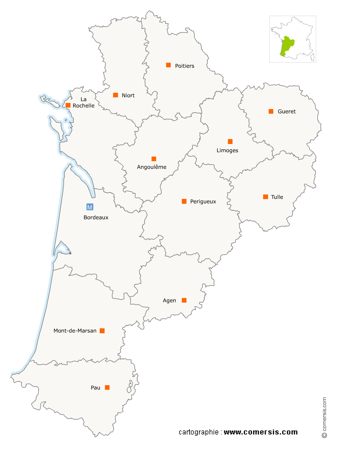
Viticulture en région Nouvelle-Aquitaine
1 755 viticulteurs sont référencés sur la région Nouvelle-Aquitaine
Vous recherchez un vigneron viticulteur en Nouvelle-Aquitaine ?
La région Nouvelle-Aquitaine représente 7% des viticulteurs de France.
C'est le département de Gironde qui compte le plus de viticulteurs en Nouvelle-Aquitaine.
C'est le département de Gironde qui compte le plus de viticulteurs en Nouvelle-Aquitaine.
Viticulture dans le Lot-et-Garonne (47)
Secteur de Duras
Indice d'implantation
| Commune | Nb Pro | Habitants | Distance | |
|---|---|---|---|---|
| Duras - 47120 | 2 | 1313 | 0,0 | km |
| Baleyssagues - 47120 | 1 | 178 | 2,5 | km |
| Savignac-de-Duras - 47120 | 3 | 220 | 2,8 | km |
| Esclottes - 47120 | 4 | 160 | 4,6 | km |
| Sainte-Colombe-de-Duras - 47120 | 1 | 113 | 5,0 | km |
| Lévignac-de-Guyenne - 47120 | 2 | 612 | 5,6 | km |
| Saint-Sernin - 47120 | 3 | 424 | 5,8 | km |
| Pardaillan - 47120 | 1 | 326 | 7,7 | km |
| Saint-Astier - 47120 | 5 | 219 | 7,9 | km |
| Monteton - 47120 | 2 | 288 | 8,1 | km |
| Villeneuve-de-Duras - 47120 | 5 | 313 | 8,3 | km |
| Saint-Jean-de-Duras - 47120 | 7 | 249 | 9,1 | km |
| Loubès-Bernac - 47120 | 5 | 342 | 10,6 | km |
| Soumensac - 47120 | 1 | 241 | 11,2 | km |
| Roumagne - 47800 | 1 | 558 | 13,6 | km |
Secteur de Nérac
Indice d'implantation
| Commune | Nb Pro | Habitants | Distance | |
|---|---|---|---|---|
| Nérac - 47600 | 2 | 7070 | 0,0 | km |
| Espiens - 47600 | 4 | 391 | 5,0 | km |
| Barbaste - 47230 | 1 | 1509 | 5,7 | km |
| Lavardac - 47230 | 1 | 2206 | 5,8 | km |
| Vianne - 47230 | 2 | 1040 | 7,0 | km |
| Mongaillard - 47230 | 4 | 187 | 8,9 | km |
| Xaintrailles - 47230 | 3 | 413 | 10,1 | km |
| Montagnac-sur-Auvignon - 47600 | 2 | 612 | 10,3 | km |
| Mézin - 47170 | 2 | 1549 | 10,9 | km |
| Montesquieu - 47130 | 2 | 767 | 11,1 | km |
| Lannes - 47170 | 2 | 389 | 11,7 | km |
| Moncaut - 47310 | 1 | 605 | 13,1 | km |
| Poudenas - 47170 | 1 | 246 | 14,1 | km |
| Sos - 47170 | 1 | 686 | 18,8 | km |
| Sainte-Maure-de-Peyriac - 47170 | 6 | 341 | 20,1 | km |
| Saint-Pé-Saint-Simon - 47170 | 1 | 219 | 23,9 | km |
Secteur de Marmande
Indice d'implantation
| Commune | Nb Pro | Habitants | Distance | |
|---|---|---|---|---|
| Marmande - 47200 | 1 | 18028 | 0,0 | km |
| Beaupuy - 47200 | 1 | 1594 | 3,9 | km |
| Marcellus - 47200 | 2 | 828 | 7,0 | km |
| Meilhan-sur-Garonne - 47180 | 1 | 1347 | 10,3 | km |
| Lachapelle - 47350 | 1 | 80 | 11,5 | km |
| Cocumont - 47250 | 4 | 1078 | 12,2 | km |
| Guérin - 47250 | 1 | 254 | 12,9 | km |
| Saint-Sauveur-de-Meilhan - 47180 | 4 | 327 | 13,2 | km |
Secteur d'Aiguillon
Indice d'implantation
| Commune | Nb Pro | Habitants | Distance | |
|---|---|---|---|---|
| Aiguillon - 47190 | 0 | 4332 | 0,0 | km |
| Port-Sainte-Marie - 47130 | 1 | 1926 | 6,9 | km |
| Saint-Pierre-de-Buzet - 47160 | 9 | 296 | 7,3 | km |
| Bazens - 47130 | 1 | 529 | 7,7 | km |
| Saint-Léon - 47160 | 1 | 312 | 8,0 | km |
| Prayssas - 47360 | 1 | 977 | 13,6 | km |
Secteur d'Agen
Indice d'implantation
| Commune | Nb Pro | Habitants | Distance | |
|---|---|---|---|---|
| Agen - 47000 | 0 | 34344 | 0,0 | km |
| Sainte-Colombe-en-Bruilhois - 47310 | 2 | 1659 | 9,0 | km |
| Laplume - 47310 | 2 | 1446 | 12,8 | km |
Secteur de Villeneuve-sur-Lot
Indice d'implantation
| Commune | Nb Pro | Habitants | Distance | |
|---|---|---|---|---|
| Villeneuve-sur-Lot - 47300 | 0 | 23462 | 0,0 | km |
| Sainte-Livrade-sur-Lot - 47110 | 1 | 6132 | 9,4 | km |
| Bourlens - 47370 | 1 | 357 | 21,1 | km |
| Thézac - 47370 | 1 | 187 | 24,6 | km |
Viticulture dans les Deux-Sèvres (79)
Secteur de Bressuire
Indice d'implantation
| Commune | Nb Pro | Habitants | Distance | |
|---|---|---|---|---|
| Bressuire - 79300 | 0 | 18962 | 0,0 | km |
| Pierrefitte - 79330 | 1 | 343 | 14,9 | km |
| Genneton - 79150 | 1 | 332 | 24,3 | km |
| Luzay - 79100 | 1 | 598 | 24,5 | km |
| Cersay - 79290 | 1 | 1011 | 25,1 | km |
| Brion-près-Thouet - 79290 | 1 | 785 | 33,2 | km |
| Saint-Martin-de-Sanzay - 79290 | 2 | 1008 | 34,9 | km |
Viticulture en Charente (16)
Secteur de Genac-Bignac
Indice d'implantation
| Commune | Nb Pro | Habitants | Distance | |
|---|---|---|---|---|
| Genac - 16170 | 5 | 975 | 0,0 | km |
| Saint-Cybardeaux - 16170 | 5 | 826 | 5,3 | km |
| Saint-Genis-d'Hiersac - 16570 | 7 | 902 | 5,3 | km |
| Saint-Amant-de-Nouère - 16170 | 8 | 422 | 6,2 | km |
| Rouillac - 16170 | 8 | 2 | 7,4 | km |
| Échallat - 16170 | 9 | 498 | 10,1 | km |
| Auge-Saint-Médard - 16170 | 3 | 823 | 10,2 | km |
| Vaux-Rouillac - 16170 | 5 | 300 | 11,1 | km |
| Mareuil - 16170 | 3 | 410 | 13,3 | km |
| Courbillac - 16200 | 3 | 697 | 16,4 | km |
| Salles-de-Villefagnan - 16700 | 1 | 343 | 20,6 | km |
| Bernac - 16700 | 1 | 482 | 29,2 | km |
| Saint-Martin-du-Clocher - 16700 | 1 | 129 | 30,7 | km |
Secteur de Châteauneuf-sur-Charente
Indice d'implantation
| Commune | Nb Pro | Habitants | Distance | |
|---|---|---|---|---|
| Châteauneuf-sur-Charente - 16120 | 6 | 3429 | 0,0 | km |
| Angeac-Charente - 16120 | 5 | 363 | 4,1 | km |
| Birac - 16120 | 3 | 368 | 4,4 | km |
| Champmillon - 16290 | 4 | 533 | 6,3 | km |
| Bouteville - 16120 | 8 | 328 | 6,9 | km |
| Bonneuil - 16120 | 7 | 262 | 7,4 | km |
| Hiersac - 16290 | 4 | 1033 | 9,2 | km |
| Lignières-Sonneville - 16130 | 19 | 613 | 11,0 | km |
Secteur de Segonzac
Indice d'implantation
| Commune | Nb Pro | Habitants | Distance | |
|---|---|---|---|---|
| Segonzac - 16130 | 45 | 2118 | 0,0 | km |
| Ambleville - 16300 | 11 | 184 | 7,3 | km |
Secteur de Châteaubernard
Indice d'implantation
| Commune | Nb Pro | Habitants | Distance | |
|---|---|---|---|---|
| Châteaubernard - 16100 | 3 | 3605 | 0,0 | km |
| Genté - 16130 | 11 | 900 | 5,0 | km |
| Gimeux - 16130 | 3 | 719 | 6,1 | km |
| Ars - 16130 | 5 | 735 | 6,3 | km |
| Saint-Fort-sur-le-Né - 16130 | 6 | 392 | 10,7 | km |
| Saint-Même-les-Carrières - 16720 | 8 | 1098 | 13,6 | km |
| Saint-Preuil - 16130 | 12 | 282 | 14,0 | km |
| Graves-Saint-Amant - 16120 | 3 | 339 | 17,4 | km |
| Mosnac - 16120 | 5 | 460 | 23,8 | km |
Secteur de Cognac
Indice d'implantation
| Commune | Nb Pro | Habitants | Distance | |
|---|---|---|---|---|
| Cognac - 16100 | 11 | 18705 | 0,0 | km |
| Javrezac - 16100 | 5 | 605 | 2,8 | km |
| Merpins - 16100 | 4 | 1034 | 5,8 | km |
| Saint-Laurent-de-Cognac - 16100 | 3 | 866 | 6,5 | km |
| Salles-d'Angles - 16130 | 14 | 1045 | 8,6 | km |
| Verrières - 16130 | 19 | 346 | 14,5 | km |
Secteur de Gensac-la-Pallue
Indice d'implantation
| Commune | Nb Pro | Habitants | Distance | |
|---|---|---|---|---|
| Gensac-la-Pallue - 16130 | 8 | 1607 | 0,0 | km |
| Bourg-Charente - 16200 | 8 | 826 | 3,1 | km |
| Angeac-Champagne - 16130 | 16 | 509 | 5,9 | km |
| Juillac-le-Coq - 16130 | 12 | 667 | 6,9 | km |
| Criteuil-la-Magdeleine - 16300 | 11 | 446 | 13,1 | km |
Secteur de Jarnac
Indice d'implantation
| Commune | Nb Pro | Habitants | Distance | |
|---|---|---|---|---|
| Jarnac - 16200 | 9 | 4449 | 0,0 | km |
| Gondeville - 16200 | 7 | 1 | 2,4 | km |
| les Métairies - 16200 | 2 | 669 | 2,6 | km |
| Chassors - 16200 | 1 | 1108 | 3,2 | km |
| Julienne - 16200 | 1 | 500 | 4,6 | km |
| Foussignac - 16200 | 7 | 612 | 5,5 | km |
| Bassac - 16120 | 3 | 539 | 5,7 | km |
| Mérignac - 16200 | 6 | 756 | 7,6 | km |
| Fleurac - 16200 | 2 | 249 | 8,2 | km |
| Malaville - 16120 | 12 | 427 | 15,1 | km |
Secteur de Boutiers-Saint-Trojan
Indice d'implantation
| Commune | Nb Pro | Habitants | Distance | |
|---|---|---|---|---|
| Boutiers-Saint-Trojan - 16100 | 2 | 1462 | 0,0 | km |
| Saint-Brice - 16100 | 4 | 974 | 3,1 | km |
| Nercillac - 16200 | 6 | 1066 | 4,1 | km |
| Réparsac - 16200 | 4 | 637 | 5,3 | km |
| Sainte-Sévère - 16200 | 5 | 552 | 7,5 | km |
| Houlette - 16200 | 4 | 384 | 8,5 | km |
| Sigogne - 16200 | 4 | 978 | 11,2 | km |
| Triac-Lautrait - 16200 | 4 | 455 | 14,7 | km |
| Saint-Simon - 16120 | 2 | 206 | 18,6 | km |
| Vibrac - 16120 | 1 | 301 | 19,8 | km |
| Moulidars - 16290 | 4 | 745 | 21,0 | km |
| Saint-Simeux - 16120 | 6 | 589 | 23,2 | km |
Secteur de Barret
Indice d'implantation
| Commune | Nb Pro | Habitants | Distance | |
|---|---|---|---|---|
| Barret - 16300 | 9 | 981 | 0,0 | km |
| Lagarde-sur-le-Né - 16300 | 2 | 168 | 3,4 | km |
| Montchaude - 16300 | 9 | 740 | 4,0 | km |
| Guimps - 16300 | 16 | 474 | 4,5 | km |
| Lachaise - 16300 | 2 | 336 | 6,0 | km |
| Saint-Palais-du-Né - 16300 | 6 | 285 | 8,4 | km |
Secteur de Baignes-Sainte-Radegonde
Indice d'implantation
| Commune | Nb Pro | Habitants | Distance | |
|---|---|---|---|---|
| Baignes-Sainte-Radegonde - 16360 | 13 | 1291 | 0,0 | km |
| Touvérac - 16360 | 4 | 688 | 2,6 | km |
| le Tâtre - 16360 | 5 | 391 | 2,8 | km |
| Reignac - 16360 | 7 | 669 | 6,0 | km |
| Chantillac - 16360 | 5 | 301 | 6,3 | km |
| Chillac - 16480 | 1 | 200 | 12,2 | km |
| Brossac - 16480 | 2 | 507 | 16,2 | km |
| Saint-Vallier - 16480 | 2 | 143 | 16,9 | km |
Secteur d'Angoulême
Indice d'implantation
| Commune | Nb Pro | Habitants | Distance | |
|---|---|---|---|---|
| Angoulême - 16000 | 1 | 41970 | 0,0 | km |
| Saint-Yrieix-sur-Charente - 16710 | 1 | 7167 | 2,7 | km |
| Fléac - 16730 | 1 | 3656 | 4,7 | km |
| Linars - 16730 | 1 | 2080 | 5,5 | km |
| Champniers - 16430 | 1 | 5205 | 8,0 | km |
| Vindelle - 16430 | 2 | 1019 | 8,0 | km |
| Asnières-sur-Nouère - 16290 | 3 | 1205 | 10,7 | km |
| Torsac - 16410 | 1 | 784 | 10,9 | km |
| Roullet-Saint-Estèphe - 16440 | 5 | 4186 | 11,4 | km |
| Marsac - 16570 | 4 | 843 | 11,6 | km |
| Sireuil - 16440 | 2 | 1168 | 11,8 | km |
| Claix - 16440 | 2 | 998 | 13,9 | km |
| Fouquebrune - 16410 | 1 | 663 | 14,5 | km |
| Plassac-Rouffiac - 16250 | 1 | 405 | 15,7 | km |
| Voulgézac - 16250 | 1 | 262 | 16,0 | km |
| Charras - 16380 | 1 | 388 | 23,7 | km |
| Édon - 16320 | 1 | 256 | 24,0 | km |
| Montmoreau-Saint-Cybard - 16190 | 1 | 1062 | 25,9 | km |
| Vaux-Lavalette - 16320 | 1 | 98 | 26,5 | km |
| Châtignac - 16480 | 1 | 187 | 36,4 | km |
| Bardenac - 16210 | 1 | 249 | 41,3 | km |
| Rouffiac - 16210 | 1 | 123 | 43,1 | km |
| Rioux-Martin - 16210 | 1 | 238 | 46,6 | km |
Secteur de Barbezieux-Saint-Hilaire
Indice d'implantation
| Commune | Nb Pro | Habitants | Distance | |
|---|---|---|---|---|
| Barbezieux-Saint-Hilaire - 16300 | 0 | 4774 | 0,0 | km |
| Salles-de-Barbezieux - 16300 | 7 | 450 | 2,9 | km |
| Saint-Bonnet - 16300 | 5 | 374 | 4,3 | km |
| Saint-Médard - 16300 | 1 | 314 | 4,6 | km |
| Condéon - 16360 | 4 | 584 | 7,3 | km |
| Challignac - 16300 | 1 | 317 | 8,4 | km |
| Saint-Aulais-la-Chapelle - 16300 | 3 | 233 | 8,4 | km |
| Brie-sous-Barbezieux - 16300 | 3 | 113 | 10,0 | km |
| Saint-Félix - 16480 | 1 | 121 | 16,5 | km |
Secteur de Val des Vignes
Indice d'implantation
| Commune | Nb Pro | Habitants | Distance | |
|---|---|---|---|---|
| Jurignac - 16250 | 4 | 1375 | 0,0 | km |
| Étriac - 16250 | 4 | 201 | 1,0 | km |
| Ladiville - 16120 | 4 | 111 | 2,9 | km |
| Vignolles - 16300 | 5 | 187 | 4,7 | km |
| Blanzac-Porcheresse - 16250 | 4 | 1 | 8,0 | km |
Secteur de Chasseneuil-sur-Bonnieure
Indice d'implantation
| Commune | Nb Pro | Habitants | Distance | |
|---|---|---|---|---|
| Chasseneuil-sur-Bonnieure - 16260 | 0 | 3042 | 0,0 | km |
| Saint-Adjutory - 16310 | 1 | 450 | 6,9 | km |
| Cherves-Châtelars - 16310 | 14 | 412 | 7,7 | km |
| Marillac-le-Franc - 16110 | 1 | 836 | 10,0 | km |
| Saint-Sornin - 16220 | 1 | 875 | 14,4 | km |
| Montbron - 16220 | 1 | 2141 | 17,8 | km |
| Chirac - 16150 | 1 | 753 | 18,8 | km |
| Saulgond - 16420 | 1 | 505 | 29,4 | km |
Secteur de Saint-Sulpice-de-Cognac
Indice d'implantation
| Commune | Nb Pro | Habitants | Distance | |
|---|---|---|---|---|
| Saint-Sulpice-de-Cognac - 16370 | 9 | 1266 | 0,0 | km |
| Mesnac - 16370 | 1 | 414 | 2,7 | km |
| Louzac-Saint-André - 16100 | 8 | 1031 | 5,7 | km |
Secteur de Vars
Indice d'implantation
| Commune | Nb Pro | Habitants | Distance | |
|---|---|---|---|---|
| Vars - 16330 | 5 | 2021 | 0,0 | km |
| Fontenille - 16230 | 1 | 344 | 17,3 | km |
| Ligné - 16140 | 1 | 162 | 17,9 | km |
| Verdille - 16140 | 1 | 331 | 22,2 | km |
| Lupsault - 16140 | 1 | 98 | 25,1 | km |
| les Gours - 16140 | 1 | 126 | 26,9 | km |
Secteur de Cherves-Richemont
Indice d'implantation
| Commune | Nb Pro | Habitants | Distance | |
|---|---|---|---|---|
| Cherves-Richemont - 16370 | 2 | 2452 | 0,0 | km |
| Bréville - 16370 | 6 | 516 | 9,2 | km |
Viticulture dans les Pyrénées-Atlantiques (64)
Secteur d'Orthez
Indice d'implantation
| Commune | Nb Pro | Habitants | Distance | |
|---|---|---|---|---|
| Orthez - 64300 | 0 | 10569 | 0,0 | km |
| Bellocq - 64270 | 1 | 897 | 12,3 | km |
| Salies-de-Béarn - 64270 | 1 | 4768 | 12,5 | km |
| Lahontan - 64270 | 1 | 486 | 16,5 | km |
| Abos - 64360 | 2 | 527 | 22,4 | km |
| Lucq-de-Béarn - 64360 | 2 | 970 | 24,3 | km |
| Monein - 64360 | 21 | 4508 | 24,5 | km |
| Parbayse - 64360 | 1 | 275 | 25,8 | km |
| Cuqueron - 64360 | 2 | 188 | 26,4 | km |
| Cardesse - 64360 | 1 | 280 | 29,2 | km |
Secteur de Pau
Indice d'implantation
| Commune | Nb Pro | Habitants | Distance | |
|---|---|---|---|---|
| Pau - 64000 | 0 | 77575 | 0,0 | km |
| Jurançon - 64110 | 6 | 7094 | 2,4 | km |
| Saint-Faust - 64110 | 1 | 763 | 7,7 | km |
| Gan - 64290 | 3 | 5535 | 8,4 | km |
| Corbère-Abères - 64350 | 1 | 111 | 30,0 | km |
| Crouseilles - 64350 | 1 | 144 | 33,6 | km |
| Aydie - 64330 | 2 | 132 | 36,6 | km |
Secteur de Bayonne
Indice d'implantation
| Commune | Nb Pro | Habitants | Distance | |
|---|---|---|---|---|
| Viodos-Abense-de-Bas - 64130 | 1 | 748 | 0,0 | km |
| Bayonne - 64100 | 0 | 47492 | 0,0 | km |
| Hasparren - 64240 | 1 | 6230 | 18,2 | km |
| Mendionde - 64240 | 1 | 845 | 22,1 | km |
| Guiche - 64520 | 1 | 949 | 22,2 | km |
| Saint-Martin-d'Arberoue - 64640 | 1 | 325 | 28,1 | km |
| Saint-Étienne-de-Baïgorry - 64430 | 2 | 1619 | 36,7 | km |
| Ispoure - 64220 | 2 | 629 | 40,8 | km |
| Saint-Jean-Pied-de-Port - 64220 | 1 | 1527 | 41,4 | km |
| Ibarrolle - 64120 | 1 | 93 | 44,8 | km |
Secteur d'Oloron-Sainte-Marie
Indice d'implantation
| Commune | Nb Pro | Habitants | Distance | |
|---|---|---|---|---|
| Oloron-Sainte-Marie - 64400 | 0 | 10794 | 0,0 | km |
| Ledeuix - 64400 | 1 | 1040 | 2,7 | km |
| Lasseube - 64290 | 3 | 1751 | 11,1 | km |
Viticulture en Charente-Maritime (17)
Secteur de Matha
Indice d'implantation
| Commune | Nb Pro | Habitants | Distance | |
|---|---|---|---|---|
| Matha - 17160 | 3 | 2214 | 0,0 | km |
| Blanzac-lès-Matha - 17160 | 2 | 341 | 2,5 | km |
| la Brousse - 17160 | 2 | 517 | 4,0 | km |
| Haimps - 17160 | 1 | 468 | 4,7 | km |
| Courcerac - 17160 | 2 | 311 | 4,7 | km |
| Mons - 17160 | 16 | 430 | 5,6 | km |
| Aujac - 17770 | 3 | 342 | 6,4 | km |
| Aumagne - 17770 | 1 | 707 | 6,6 | km |
| Louzignac - 17160 | 1 | 156 | 7,3 | km |
| Brie-sous-Matha - 17160 | 2 | 192 | 7,5 | km |
| Massac - 17490 | 1 | 155 | 7,6 | km |
| Authon-Ébéon - 17770 | 3 | 395 | 7,7 | km |
| Gourvillette - 17490 | 1 | 103 | 7,9 | km |
| Ballans - 17160 | 1 | 222 | 9,7 | km |
| Beauvais-sur-Matha - 17490 | 2 | 656 | 10,3 | km |
| Macqueville - 17490 | 3 | 298 | 11,1 | km |
| Bercloux - 17770 | 5 | 452 | 12,4 | km |
| Neuvicq-le-Château - 17490 | 5 | 358 | 14,0 | km |
Secteur de Pons
Indice d'implantation
| Commune | Nb Pro | Habitants | Distance | |
|---|---|---|---|---|
| Pons - 17800 | 4 | 4116 | 0,0 | km |
| Bougneau - 17800 | 1 | 598 | 3,5 | km |
| Avy - 17800 | 1 | 464 | 3,9 | km |
| Fléac-sur-Seugne - 17800 | 2 | 383 | 4,7 | km |
| Biron - 17800 | 4 | 223 | 5,6 | km |
| Échebrune - 17800 | 7 | 492 | 8,0 | km |
| Marignac - 17800 | 4 | 414 | 8,2 | km |
| Chadenac - 17800 | 5 | 449 | 9,1 | km |
| Champagnolles - 17240 | 2 | 611 | 9,7 | km |
| Coulonges - 17800 | 5 | 253 | 10,4 | km |
| Jarnac-Champagne - 17520 | 9 | 764 | 11,6 | km |
| Lonzac - 17520 | 2 | 252 | 12,2 | km |
| Brives-sur-Charente - 17800 | 2 | 253 | 12,9 | km |
| Celles - 17520 | 4 | 330 | 14,2 | km |
Secteur de Chaniers
Indice d'implantation
| Commune | Nb Pro | Habitants | Distance | |
|---|---|---|---|---|
| Chaniers - 17610 | 4 | 3519 | 0,0 | km |
| Courcoury - 17100 | 1 | 703 | 1,9 | km |
| la Chapelle-des-Pots - 17100 | 3 | 983 | 5,0 | km |
| Dompierre-sur-Charente - 17610 | 2 | 475 | 5,2 | km |
| Rouffiac - 17800 | 5 | 468 | 6,3 | km |
| Colombiers - 17460 | 1 | 324 | 8,1 | km |
| Montils - 17800 | 1 | 827 | 8,7 | km |
| Chérac - 17610 | 12 | 1100 | 9,4 | km |
| Burie - 17770 | 10 | 1266 | 12,1 | km |
| Écoyeux - 17770 | 2 | 1306 | 12,5 | km |
| Migron - 17770 | 10 | 733 | 15,7 | km |
Secteur de Montendre
Indice d'implantation
| Commune | Nb Pro | Habitants | Distance | |
|---|---|---|---|---|
| Montendre - 17130 | 3 | 3226 | 0,0 | km |
| Corignac - 17130 | 1 | 372 | 4,4 | km |
| Jussas - 17130 | 2 | 124 | 4,9 | km |
| Expiremont - 17130 | 1 | 129 | 5,2 | km |
| Chamouillac - 17130 | 3 | 363 | 5,5 | km |
| Rouffignac - 17130 | 5 | 447 | 6,5 | km |
| Messac - 17130 | 1 | 108 | 10,2 | km |
| Bran - 17210 | 1 | 125 | 13,3 | km |
| Saint-Maigrin - 17520 | 4 | 570 | 17,9 | km |
| Saint-Ciers-Champagne - 17520 | 1 | 428 | 19,4 | km |
| Saint-Martial-de-Vitaterne - 17500 | 1 | 530 | 19,9 | km |
| Saint-Grégoire-d'Ardennes - 17240 | 1 | 145 | 25,6 | km |
| Saint-Eugène - 17520 | 9 | 276 | 26,5 | km |
| Sainte-Lheurine - 17520 | 12 | 519 | 27,5 | km |
| Saint-Quantin-de-Rançanne - 17800 | 1 | 290 | 31,1 | km |
| Saint-Germain-du-Seudre - 17240 | 1 | 406 | 32,4 | km |
| Saint-Léger - 17800 | 3 | 612 | 40,0 | km |
Secteur de Mirambeau
Indice d'implantation
| Commune | Nb Pro | Habitants | Distance | |
|---|---|---|---|---|
| Mirambeau - 17150 | 3 | 1483 | 0,0 | km |
| Saint-Georges-des-Agoûts - 17150 | 1 | 260 | 5,9 | km |
| Allas-Bocage - 17150 | 1 | 220 | 6,4 | km |
| Boisredon - 17150 | 1 | 720 | 6,9 | km |
| Saint-Bonnet-sur-Gironde - 17150 | 8 | 838 | 7,2 | km |
| Saint-Ciers-du-Taillon - 17240 | 2 | 558 | 7,7 | km |
| Courpignac - 17130 | 3 | 409 | 7,9 | km |
| Saint-Genis-de-Saintonge - 17240 | 1 | 1241 | 12,2 | km |
| Saint-Germain-de-Lusignan - 17500 | 4 | 1256 | 12,3 | km |
| Saint-Dizant-du-Gua - 17240 | 4 | 530 | 12,4 | km |
| Lorignac - 17240 | 4 | 489 | 13,2 | km |
| Saint-Fort-sur-Gironde - 17240 | 3 | 885 | 15,2 | km |
| Réaux - 17500 | 5 | 792 | 19,3 | km |
| Pérignac - 17800 | 10 | 992 | 29,3 | km |
Secteur de Jonzac
Indice d'implantation
| Commune | Nb Pro | Habitants | Distance | |
|---|---|---|---|---|
| Jonzac - 17500 | 2 | 3465 | 0,0 | km |
| Champagnac - 17500 | 4 | 538 | 5,0 | km |
| Clam - 17500 | 1 | 412 | 5,4 | km |
| Clion - 17240 | 1 | 834 | 6,2 | km |
| Neulles - 17500 | 3 | 152 | 6,7 | km |
| Ozillac - 17500 | 3 | 645 | 6,7 | km |
| Meux - 17500 | 3 | 296 | 7,1 | km |
| Fontaines-d'Ozillac - 17500 | 1 | 529 | 8,0 | km |
| Neuillac - 17520 | 1 | 307 | 8,6 | km |
| Allas-Champagne - 17500 | 5 | 281 | 8,6 | km |
| Mosnac - 17240 | 2 | 457 | 9,4 | km |
| Mortiers - 17500 | 1 | 196 | 10,3 | km |
| Léoville - 17500 | 1 | 323 | 10,8 | km |
| Brie-sous-Archiac - 17520 | 6 | 253 | 11,1 | km |
| Arthenac - 17520 | 8 | 338 | 12,3 | km |
| Archiac - 17520 | 3 | 779 | 13,6 | km |
| Mazerolles - 17800 | 1 | 247 | 16,1 | km |
| Germignac - 17520 | 4 | 650 | 16,1 | km |
Secteur de Saint-Jean-d'Angély
Indice d'implantation
| Commune | Nb Pro | Habitants | Distance | |
|---|---|---|---|---|
| Saint-Jean-d'Angély - 17400 | 1 | 7295 | 0,0 | km |
| Varaize - 17400 | 1 | 557 | 7,7 | km |
| Nantillé - 17770 | 1 | 324 | 8,5 | km |
| Sainte-Même - 17770 | 1 | 254 | 8,8 | km |
| Saint-Hilaire-de-Villefranche - 17770 | 4 | 1 | 10,6 | km |
| Saint-Martial - 17330 | 3 | 123 | 12,1 | km |
| Prignac - 17160 | 2 | 290 | 18,0 | km |
| les Touches-de-Périgny - 17160 | 9 | 566 | 19,8 | km |
| Thors - 17160 | 2 | 447 | 20,4 | km |
| Sonnac - 17160 | 11 | 542 | 22,5 | km |
| Seigné - 17510 | 1 | 93 | 23,7 | km |
Secteur de Montguyon
Indice d'implantation
| Commune | Nb Pro | Habitants | Distance | |
|---|---|---|---|---|
| Montguyon - 17270 | 3 | 1506 | 0,0 | km |
| Saint-Martin-d'Ary - 17270 | 4 | 472 | 2,1 | km |
| Neuvicq - 17270 | 2 | 405 | 2,8 | km |
| Clérac - 17270 | 1 | 986 | 5,0 | km |
| le Fouilloux - 17270 | 3 | 755 | 5,7 | km |
| Saint-Palais-de-Négrignac - 17210 | 1 | 430 | 6,1 | km |
| Montlieu-la-Garde - 17210 | 1 | 1324 | 6,2 | km |
| Cercoux - 17270 | 2 | 1208 | 10,0 | km |
| Sousmoulins - 17130 | 1 | 214 | 15,0 | km |
| Tugéras-Saint-Maurice - 17130 | 1 | 362 | 23,5 | km |
| Saint-Simon-de-Bordes - 17500 | 5 | 725 | 28,8 | km |
| Semoussac - 17150 | 3 | 300 | 39,0 | km |
| Saint-Sorlin-de-Conac - 17150 | 1 | 204 | 42,0 | km |
| Saint-Thomas-de-Conac - 17150 | 4 | 556 | 43,5 | km |
| Sainte-Ramée - 17240 | 1 | 136 | 43,6 | km |
Secteur de Gémozac
Indice d'implantation
| Commune | Nb Pro | Habitants | Distance | |
|---|---|---|---|---|
| Gémozac - 17260 | 7 | 2802 | 0,0 | km |
| Tanzac - 17260 | 3 | 311 | 3,8 | km |
| Virollet - 17260 | 7 | 248 | 3,8 | km |
| Jazennes - 17260 | 1 | 492 | 4,8 | km |
| Saint-André-de-Lidon - 17260 | 2 | 1049 | 6,5 | km |
| Tesson - 17460 | 1 | 995 | 7,2 | km |
| Rioux - 17460 | 1 | 937 | 7,8 | km |
| Berneuil - 17460 | 2 | 1134 | 10,1 | km |
| Rétaud - 17460 | 2 | 1077 | 12,6 | km |
| Meursac - 17120 | 3 | 1435 | 13,6 | km |
| Thézac - 17600 | 3 | 323 | 14,3 | km |
Secteur de Royan
Indice d'implantation
| Commune | Nb Pro | Habitants | Distance | |
|---|---|---|---|---|
| Royan - 17200 | 1 | 18138 | 0,0 | km |
| Semussac - 17120 | 1 | 2198 | 9,8 | km |
| le Chay - 17600 | 1 | 759 | 10,7 | km |
| Nieulle-sur-Seudre - 17600 | 1 | 1195 | 13,7 | km |
| Talmont-sur-Gironde - 17120 | 1 | 103 | 14,0 | km |
| Grézac - 17120 | 1 | 894 | 15,1 | km |
| Sablonceaux - 17600 | 1 | 1346 | 15,2 | km |
| Cozes - 17120 | 2 | 2067 | 16,2 | km |
| Nancras - 17600 | 1 | 779 | 17,7 | km |
| Barzan - 17120 | 2 | 469 | 17,7 | km |
| Sainte-Gemme - 17250 | 1 | 1270 | 19,7 | km |
| Épargnes - 17120 | 7 | 850 | 20,0 | km |
| Chenac-Saint-Seurin-d'Uzet - 17120 | 2 | 582 | 20,1 | km |
| Mortagne-sur-Gironde - 17120 | 4 | 995 | 25,0 | km |
| Floirac - 17120 | 4 | 313 | 27,6 | km |
Secteur de Saint-Pierre-d'Oléron
Indice d'implantation
| Commune | Nb Pro | Habitants | Distance | |
|---|---|---|---|---|
| Saint-Pierre-d'Oléron - 17310 | 10 | 6637 | 0,0 | km |
| Saint-Georges-d'Oléron - 17190 | 10 | 3529 | 4,4 | km |
| Dolus-d'Oléron - 17550 | 1 | 3230 | 5,0 | km |
| la Brée-les-Bains - 17840 | 1 | 718 | 8,5 | km |
| Saint-Denis-d'Oléron - 17650 | 2 | 1361 | 11,3 | km |
Secteur de Saintes
Indice d'implantation
| Commune | Nb Pro | Habitants | Distance | |
|---|---|---|---|---|
| Saintes - 17100 | 0 | 25601 | 0,0 | km |
| Chermignac - 17460 | 1 | 1269 | 7,6 | km |
| Thénac - 17460 | 1 | 1638 | 8,8 | km |
| Saint-Césaire - 17770 | 1 | 918 | 10,3 | km |
| Saint-Sauvant - 17610 | 2 | 497 | 10,3 | km |
| Saint-Bris-des-Bois - 17770 | 4 | 407 | 11,6 | km |
| Villars-les-Bois - 17770 | 8 | 264 | 16,7 | km |
| le Seure - 17770 | 3 | 249 | 21,7 | km |
Secteur de Sainte-Marie-de-Ré
Indice d'implantation
| Commune | Nb Pro | Habitants | Distance | |
|---|---|---|---|---|
| Sainte-Marie-de-Ré - 17740 | 4 | 3323 | 0,0 | km |
| la Flotte - 17630 | 2 | 2897 | 4,3 | km |
| le Bois-Plage-en-Ré - 17580 | 3 | 2350 | 7,4 | km |
| la Couarde-sur-Mer - 17670 | 3 | 1228 | 9,9 | km |
| Loix - 17111 | 1 | 677 | 12,7 | km |
| Ars-en-Ré - 17590 | 1 | 1280 | 16,9 | km |
Secteur de Saint-Aigulin
Indice d'implantation
| Commune | Nb Pro | Habitants | Distance | |
|---|---|---|---|---|
| Saint-Aigulin - 17360 | 5 | 1901 | 0,0 | km |
| la Barde - 17360 | 1 | 467 | 4,4 | km |
| la Genétouze - 17360 | 1 | 209 | 7,0 | km |
| Saint-Martin-de-Coux - 17360 | 4 | 439 | 7,8 | km |
Secteur de Saint-Savinien
Indice d'implantation
| Commune | Nb Pro | Habitants | Distance | |
|---|---|---|---|---|
| Saint-Savinien - 17350 | 0 | 2452 | 0,0 | km |
| Annepont - 17350 | 1 | 358 | 6,2 | km |
| Juicq - 17770 | 2 | 273 | 10,0 | km |
Secteur de Saint-Georges-des-Coteaux
Indice d'implantation
| Commune | Nb Pro | Habitants | Distance | |
|---|---|---|---|---|
| Saint-Georges-des-Coteaux - 17810 | 0 | 2636 | 0,0 | km |
| Corme-Royal - 17600 | 1 | 1664 | 8,0 | km |
Secteur de Rochelle
Indice d'implantation
| Commune | Nb Pro | Habitants | Distance | |
|---|---|---|---|---|
| la Rochelle - 17000 | 0 | 74344 | 0,0 | km |
| Aytré - 17440 | 1 | 8844 | 4,3 | km |
Viticulture en Corrèze (19)
Secteur de Brive-la-Gaillarde
Indice d'implantation
| Commune | Nb Pro | Habitants | Distance | |
|---|---|---|---|---|
| Brive-la-Gaillarde - 19100 | 2 | 46794 | 0,0 | km |
| Saint-Pantaléon-de-Larche - 19600 | 1 | 4763 | 7,0 | km |
| Varetz - 19240 | 1 | 2316 | 7,6 | km |
| Jugeals-Nazareth - 19500 | 1 | 915 | 8,9 | km |
| Larche - 19600 | 1 | 1606 | 10,1 | km |
| Lanteuil - 19190 | 1 | 542 | 10,4 | km |
| Allassac - 19240 | 2 | 3869 | 12,2 | km |
| Nespouls - 19600 | 1 | 660 | 12,4 | km |
| Beynat - 19190 | 1 | 1280 | 15,3 | km |
| Voutezac - 19130 | 1 | 1266 | 16,6 | km |
| Saint-Cyr-la-Roche - 19130 | 2 | 487 | 16,8 | km |
| Branceilles - 19500 | 3 | 261 | 21,1 | km |
| Saint-Robert - 19310 | 1 | 332 | 21,7 | km |
| la Chapelle-aux-Saints - 19120 | 1 | 248 | 24,2 | km |
Viticulture dans la Vienne (86)
Secteur de Loudun
Indice d'implantation
| Commune | Nb Pro | Habitants | Distance | |
|---|---|---|---|---|
| Loudun - 86200 | 0 | 6780 | 0,0 | km |
| Saint-Léger-de-Montbrillais - 86120 | 1 | 371 | 11,8 | km |
| Berrie - 86120 | 1 | 260 | 13,1 | km |
| Pouançay - 86120 | 1 | 238 | 13,9 | km |
| Saix - 86120 | 3 | 289 | 15,6 | km |
| Coussay - 86110 | 1 | 245 | 21,3 | km |
| Chouppes - 86110 | 1 | 761 | 22,8 | km |
| Mirebeau - 86110 | 1 | 2174 | 26,1 | km |
| Maisonneuve - 86170 | 1 | 316 | 31,9 | km |
| Cherves - 86170 | 1 | 576 | 32,7 | km |
| Neuville-de-Poitou - 86170 | 1 | 5336 | 38,2 | km |
Viticulture en Dordogne (24)
Secteur de Saint-Antoine-de-Breuilh
Indice d'implantation
| Commune | Nb Pro | Habitants | Distance | |
|---|---|---|---|---|
| Saint-Antoine-de-Breuilh - 24230 | 7 | 1967 | 0,0 | km |
| Nastringues - 24230 | 2 | 102 | 3,5 | km |
| Fougueyrolles - 33220 | 8 | 484 | 3,5 | km |
| Vélines - 24230 | 9 | 1109 | 3,9 | km |
| Montazeau - 24230 | 4 | 309 | 5,5 | km |
| Saint-Seurin-de-Prats - 24230 | 2 | 472 | 6,2 | km |
| Saint-Vivien - 24230 | 1 | 274 | 6,5 | km |
| Montcaret - 24230 | 8 | 1437 | 7,2 | km |
| Saint-Méard-de-Gurçon - 24610 | 7 | 770 | 7,5 | km |
| Lamothe-Montravel - 24230 | 3 | 1283 | 10,2 | km |
| Montpeyroux - 24610 | 1 | 458 | 11,1 | km |
| Saint-Martin-de-Gurson - 24610 | 1 | 644 | 12,4 | km |
| Carsac-de-Gurson - 24610 | 1 | 195 | 12,4 | km |
| Minzac - 24610 | 3 | 454 | 16,7 | km |
| Saint-Laurent-des-Hommes - 24400 | 1 | 1048 | 22,8 | km |
Secteur de Lamonzie-Saint-Martin
Indice d'implantation
| Commune | Nb Pro | Habitants | Distance | |
|---|---|---|---|---|
| Lamonzie-Saint-Martin - 24680 | 1 | 2447 | 0,0 | km |
| Gardonne - 24680 | 2 | 1521 | 4,1 | km |
| Gageac-et-Rouillac - 24240 | 9 | 423 | 5,6 | km |
| Cunèges - 24240 | 3 | 297 | 7,2 | km |
| Pomport - 24240 | 33 | 820 | 7,4 | km |
| Monestier - 24240 | 9 | 375 | 8,9 | km |
| Mescoules - 24240 | 1 | 172 | 11,1 | km |
Secteur de Port-Sainte-Foy-et-Ponchapt
Indice d'implantation
| Commune | Nb Pro | Habitants | Distance | |
|---|---|---|---|---|
| Port-Sainte-Foy-et-Ponchapt - 33220 | 4 | 2498 | 0,0 | km |
| Eynesse - 33220 | 4 | 580 | 4,7 | km |
| Caplong - 33220 | 9 | 228 | 9,2 | km |
| Massugas - 33790 | 9 | 237 | 12,7 | km |
| Pellegrue - 33790 | 22 | 1037 | 15,3 | km |
| Listrac-de-Durèze - 33790 | 1 | 176 | 15,7 | km |
| Auriolles - 33790 | 5 | 122 | 16,8 | km |
Secteur de Bergerac
Indice d'implantation
| Commune | Nb Pro | Habitants | Distance | |
|---|---|---|---|---|
| Bergerac - 24100 | 16 | 28063 | 0,0 | km |
| Lembras - 24100 | 1 | 1213 | 4,7 | km |
| Monbazillac - 24240 | 27 | 906 | 6,6 | km |
| Colombier - 24560 | 7 | 238 | 9,3 | km |
Secteur de La Force
Indice d'implantation
| Commune | Nb Pro | Habitants | Distance | |
|---|---|---|---|---|
| la Force - 24130 | 0 | 2568 | 0,0 | km |
| Saint-Pierre-d'Eyraud - 24130 | 1 | 1762 | 5,0 | km |
| Saussignac - 24240 | 17 | 429 | 8,4 | km |
| Razac-de-Saussignac - 24240 | 12 | 347 | 10,0 | km |
| le Fleix - 24130 | 4 | 1487 | 10,2 | km |
| Monfaucon - 24130 | 2 | 293 | 11,8 | km |
Secteur de Prigonrieux
Indice d'implantation
| Commune | Nb Pro | Habitants | Distance | |
|---|---|---|---|---|
| Prigonrieux - 24130 | 4 | 4176 | 0,0 | km |
| Saint-Laurent-des-Vignes - 24100 | 10 | 900 | 6,3 | km |
| Rouffignac-de-Sigoulès - 24240 | 8 | 347 | 9,2 | km |
| Sigoulès - 24240 | 1 | 1 | 11,1 | km |
| Thénac - 24240 | 7 | 371 | 12,9 | km |
Secteur d'Eymet
Indice d'implantation
| Commune | Nb Pro | Habitants | Distance | |
|---|---|---|---|---|
| Eymet - 24500 | 1 | 2639 | 0,0 | km |
| Fonroque - 24500 | 1 | 306 | 4,3 | km |
| Razac-d'Eymet - 24500 | 1 | 302 | 5,6 | km |
| Saint-Aubin-de-Cadelech - 24500 | 1 | 323 | 7,2 | km |
| Singleyrac - 24500 | 1 | 312 | 9,6 | km |
| Sadillac - 24500 | 2 | 110 | 10,3 | km |
| Saint-Perdoux - 24560 | 2 | 136 | 14,0 | km |
| Plaisance - 24560 | 3 | 438 | 14,0 | km |
| Saint-Cernin-de-Labarde - 24560 | 2 | 204 | 17,6 | km |
| Conne-de-Labarde - 24560 | 3 | 238 | 17,8 | km |
| Boisse - 24560 | 2 | 249 | 21,0 | km |
| FAUX - 24560 | 1 | 604 | 23,9 | km |
| Saint-Agne - 24520 | 1 | 422 | 26,6 | km |
| Vergt-de-Biron - 24540 | 1 | 188 | 35,5 | km |
| Biron - 24540 | 1 | 188 | 37,7 | km |
Secteur de Sarlat-la-Canéda
Indice d'implantation
| Commune | Nb Pro | Habitants | Distance | |
|---|---|---|---|---|
| Sarlat-la-Canéda - 24200 | 0 | 9259 | 0,0 | km |
| Saint-André-d'Allas - 24200 | 1 | 823 | 3,9 | km |
| Beynac-et-Cazenac - 24220 | 1 | 554 | 7,5 | km |
| Saint-Cybranet - 24250 | 1 | 410 | 11,8 | km |
| Borrèze - 24590 | 1 | 355 | 15,6 | km |
| Daglan - 24250 | 1 | 556 | 16,4 | km |
| les Eyzies-de-Tayac-Sireuil - 24620 | 1 | 1 | 16,8 | km |
| Saint-Avit-de-Vialard - 24260 | 4 | 169 | 28,0 | km |
| Villefranche-du-Périgord - 24550 | 4 | 717 | 30,7 | km |
| Monpazier - 24540 | 1 | 548 | 34,3 | km |
Secteur de Périgueux
Indice d'implantation
| Commune | Nb Pro | Habitants | Distance | |
|---|---|---|---|---|
| Périgueux - 24000 | 0 | 30036 | 0,0 | km |
| Montrem - 24110 | 1 | 1262 | 11,7 | km |
| Creyssensac-et-Pissot - 24380 | 2 | 251 | 12,5 | km |
| Léguillac-de-l'Auche - 24110 | 1 | 1005 | 12,9 | km |
| Manzac-sur-Vern - 24110 | 1 | 586 | 14,9 | km |
| Paussac-et-Saint-Vivien - 24310 | 3 | 436 | 23,0 | km |
| Saint-André-de-Double - 24190 | 1 | 163 | 31,8 | km |
| Pressignac-Vicq - 24150 | 1 | 476 | 32,4 | km |
| Paunat - 24510 | 1 | 309 | 33,0 | km |
| Petit-Bersac - 24600 | 2 | 173 | 40,1 | km |
Secteur de Creysse
Indice d'implantation
| Commune | Nb Pro | Habitants | Distance | |
|---|---|---|---|---|
| Creysse - 24100 | 5 | 1780 | 0,0 | km |
| Saint-Sauveur - 24520 | 1 | 815 | 2,1 | km |
| Saint-Nexans - 24520 | 3 | 909 | 5,8 | km |
| Ribagnac - 24240 | 1 | 331 | 11,5 | km |
Viticulture dans les Landes (40)
Secteur de Roquefort
Indice d'implantation
| Commune | Nb Pro | Habitants | Distance | |
|---|---|---|---|---|
| Roquefort - 40120 | 0 | 1855 | 0,0 | km |
| Saint-Justin - 40240 | 1 | 973 | 9,3 | km |
| le Frêche - 40190 | 2 | 382 | 13,1 | km |
| Labastide-d'Armagnac - 40240 | 3 | 689 | 13,1 | km |
| Betbezer-d'Armagnac - 40240 | 1 | 139 | 13,7 | km |
| Saint-Cricq-Villeneuve - 40190 | 1 | 466 | 16,2 | km |
| Saint-Julien-d'Armagnac - 40240 | 1 | 109 | 16,5 | km |
| Perquie - 40190 | 3 | 361 | 17,7 | km |
| Lagrange - 40240 | 2 | 203 | 19,0 | km |
| Parleboscq - 40310 | 4 | 517 | 28,2 | km |
| Escalans - 40310 | 1 | 271 | 29,8 | km |
Secteur d'Aire-sur-l'Adour
Indice d'implantation
| Commune | Nb Pro | Habitants | Distance | |
|---|---|---|---|---|
| Aire-sur-l'Adour - 40800 | 1 | 6156 | 0,0 | km |
| Duhort-Bachen - 40800 | 1 | 657 | 5,5 | km |
| Bahus-Soubiran - 40320 | 1 | 405 | 8,0 | km |
| le Vignau - 40270 | 1 | 507 | 8,9 | km |
| Aurensan - 32400 | 1 | 138 | 10,4 | km |
| Mauries - 40320 | 1 | 95 | 10,9 | km |
| Payros-Cazautets - 40320 | 1 | 105 | 13,4 | km |
| Vielle-Tursan - 40320 | 1 | 278 | 15,3 | km |
| Bourdalat - 40190 | 1 | 225 | 16,0 | km |
| Hagetmau - 40700 | 1 | 4569 | 27,2 | km |