
Exploitation forestière et sylviculture en région Bretagne
217 exploitations forestières sont référencés sur la région Bretagne
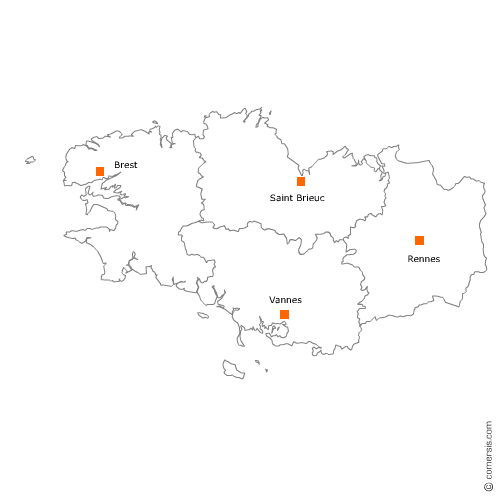
Vous recherchez un exploitant forestier en Bretagne ?
La région Bretagne représente 3% des exploitations forestières de France.
C'est le département du Morbihan qui compte le plus d'exploitations forestières en Bretagne.
C'est le département du Morbihan qui compte le plus d'exploitations forestières en Bretagne.
Exploitation forestière et sylviculture en Ille-et-Vilaine (35)
Secteur de Saint-Malo
Indice d'implantation
| Commune | Nb Pro | Habitants | Distance | |
|---|---|---|---|---|
| Saint-Malo - 35400 | 2 | 44919 | 0,0 | km |
| Saint-Jouan-des-Guérets - 35430 | 1 | 2569 | 4,9 | km |
| Saint-Suliac - 35430 | 1 | 958 | 7,7 | km |
| Saint-Père - 35430 | 1 | 2232 | 8,2 | km |
| la Ville-ès-Nonais - 35430 | 1 | 1125 | 10,5 | km |
| Hirel - 35120 | 1 | 1350 | 15,9 | km |
| Plerguer - 35540 | 1 | 2497 | 16,9 | km |
| Saint-Pierre-de-Plesguen - 35720 | 1 | 4 | 22,1 | km |
| Bonnemain - 35270 | 1 | 1446 | 25,9 | km |
| Pleugueneuc - 35720 | 2 | 1773 | 27,7 | km |
| Meillac - 35270 | 1 | 1767 | 28,9 | km |
| Trévérien - 35190 | 1 | 896 | 30,0 | km |
Secteur de Redon
Indice d'implantation
| Commune | Nb Pro | Habitants | Distance | |
|---|---|---|---|---|
| Redon - 35600 | 2 | 9114 | 0,0 | km |
| Saint-Vincent-sur-Oust - 56350 | 1 | 1421 | 7,0 | km |
| Saint-Jacut-les-Pins - 56220 | 1 | 1728 | 10,6 | km |
| Sixt-sur-Aff - 35550 | 1 | 2105 | 13,7 | km |
| Guémené-Penfao - 44290 | 1 | 5248 | 18,8 | km |
| Plessé - 44630 | 2 | 5017 | 19,2 | km |
Secteur de Rennes
Indice d'implantation
| Commune | Nb Pro | Habitants | Distance | |
|---|---|---|---|---|
| Rennes - 35000 | 2 | 211373 | 0,0 | km |
| Saint-Armel - 35230 | 1 | 1848 | 12,6 | km |
| Bourgbarré - 35230 | 1 | 3737 | 13,3 | km |
| Brécé - 35530 | 1 | 2051 | 14,9 | km |
| Saint-Aubin-d'Aubigné - 35250 | 1 | 3393 | 18,1 | km |
| Dingé - 35440 | 1 | 1667 | 28,0 | km |
| Quédillac - 35290 | 1 | 1185 | 37,6 | km |
Secteur de Guichen
Indice d'implantation
| Commune | Nb Pro | Habitants | Distance | |
|---|---|---|---|---|
| Guichen - 35580 | 0 | 8095 | 0,0 | km |
| Goven - 35580 | 2 | 4417 | 5,6 | km |
| Bourg-des-Comptes - 35890 | 1 | 3234 | 6,2 | km |
| Baulon - 35580 | 1 | 2094 | 10,3 | km |
| Messac - 35480 | 1 | 6735 | 16,1 | km |
| Plélan-le-Grand - 35380 | 1 | 3691 | 22,8 | km |
| Paimpont - 35380 | 1 | 1637 | 28,3 | km |
Secteur de Bain-de-Bretagne
Indice d'implantation
| Commune | Nb Pro | Habitants | Distance | |
|---|---|---|---|---|
| Bain-de-Bretagne - 35470 | 0 | 7512 | 0,0 | km |
| la Dominelais - 35390 | 2 | 1307 | 8,7 | km |
| Grand-Fougeray - 35390 | 2 | 2417 | 13,6 | km |
Secteur de Vitré
Indice d'implantation
| Commune | Nb Pro | Habitants | Distance | |
|---|---|---|---|---|
| Vitré - 35500 | 0 | 17463 | 0,0 | km |
| Pocé-les-Bois - 35500 | 1 | 1247 | 3,1 | km |
| Montreuil-des-Landes - 35210 | 1 | 241 | 13,5 | km |
| la Guerche-de-Bretagne - 35130 | 1 | 4277 | 20,4 | km |
| Rannée - 35130 | 1 | 1121 | 22,5 | km |
Secteur de Fougères
Indice d'implantation
| Commune | Nb Pro | Habitants | Distance | |
|---|---|---|---|---|
| Fougères - 35133 | 0 | 20170 | 0,0 | km |
| Laignelet - 35133 | 1 | 1135 | 4,4 | km |
| Saint-Hilaire-des-Landes - 35140 | 1 | 1016 | 11,6 | km |
| Saint-Marc-le-Blanc - 35460 | 1 | 1 | 15,4 | km |
Exploitation forestière et sylviculture dans les Côtes d'Armor (22)
Secteur de Lannion
Indice d'implantation
| Commune | Nb Pro | Habitants | Distance | |
|---|---|---|---|---|
| Lannion - 22300 | 1 | 19627 | 0,0 | km |
| Ploubezre - 22300 | 1 | 3608 | 3,3 | km |
| Pleumeur-Bodou - 22560 | 1 | 3983 | 6,2 | km |
| Plouaret - 22420 | 1 | 2164 | 13,7 | km |
| Lanvellec - 22420 | 1 | 572 | 14,1 | km |
| Penvénan - 22710 | 1 | 2609 | 14,6 | km |
| Trégrom - 22420 | 1 | 402 | 15,3 | km |
| Plounérin - 22780 | 1 | 735 | 19,7 | km |
| Plounévez-Moëdec - 22810 | 3 | 1443 | 19,8 | km |
Secteur de Loudéac
Indice d'implantation
| Commune | Nb Pro | Habitants | Distance | |
|---|---|---|---|---|
| Loudéac - 22600 | 3 | 9711 | 0,0 | km |
| Saint-Barnabé - 22600 | 1 | 1265 | 5,9 | km |
| la Prénessaye - 22210 | 1 | 868 | 8,9 | km |
| Merdrignac - 22230 | 3 | 2906 | 25,4 | km |
| Trémorel - 22230 | 2 | 1119 | 34,7 | km |
Secteur de Paimpol
Indice d'implantation
| Commune | Nb Pro | Habitants | Distance | |
|---|---|---|---|---|
| Plusquellec - 22160 | 1 | 563 | 0,0 | km |
| Paimpol - 22500 | 0 | 7298 | 0,0 | km |
| Pléhédel - 22290 | 1 | 1290 | 9,7 | km |
| Pontrieux - 22260 | 1 | 1021 | 12,4 | km |
| Gommenec'h - 22290 | 1 | 544 | 15,3 | km |
| Lanvollon - 22290 | 1 | 1749 | 17,1 | km |
| Pléguien - 22290 | 1 | 1282 | 17,9 | km |
| Pommerit-le-Vicomte - 22200 | 1 | 1824 | 18,0 | km |
| Goudelin - 22290 | 1 | 1701 | 19,5 | km |
| Saint-Agathon - 22200 | 1 | 2197 | 24,9 | km |
| Guingamp - 22200 | 1 | 7106 | 25,4 | km |
Secteur de Saint-Brieuc
Indice d'implantation
| Commune | Nb Pro | Habitants | Distance | |
|---|---|---|---|---|
| Saint-Brieuc - 22000 | 1 | 45331 | 0,0 | km |
| Plaine-Haute - 22800 | 1 | 1515 | 9,7 | km |
| Étables-sur-Mer - 22680 | 1 | 3022 | 13,4 | km |
| Quessoy - 22120 | 1 | 3830 | 13,5 | km |
| Saint-Brandan - 22800 | 1 | 2386 | 15,6 | km |
| Lamballe - 22400 | 1 | 16 | 19,8 | km |
| Lanfains - 22800 | 1 | 1074 | 20,7 | km |
| Quintenic - 22400 | 2 | 348 | 25,7 | km |
Secteur de Dinan
Indice d'implantation
| Commune | Nb Pro | Habitants | Distance | |
|---|---|---|---|---|
| Dinan - 22100 | 0 | 10940 | 0,0 | km |
| Taden - 22100 | 1 | 2288 | 3,4 | km |
| Évran - 22630 | 1 | 1742 | 9,3 | km |
| Saint-Judoce - 22630 | 1 | 580 | 12,1 | km |
| Trémeur - 22250 | 1 | 691 | 19,7 | km |
| Pléven - 22130 | 1 | 572 | 20,3 | km |
| Jugon-les-Lacs - 22270 | 1 | 2489 | 20,8 | km |
| Landébia - 22130 | 1 | 492 | 22,4 | km |
Exploitation forestière et sylviculture dans le Morbihan (56)
Secteur de Guer
Indice d'implantation
| Commune | Nb Pro | Habitants | Distance | |
|---|---|---|---|---|
| Guer - 56380 | 1 | 6310 | 0,0 | km |
| Carentoir - 56910 | 1 | 2721 | 9,7 | km |
| Augan - 56800 | 4 | 1551 | 11,7 | km |
| Campénéac - 56800 | 2 | 1917 | 14,1 | km |
| Concoret - 56430 | 2 | 735 | 18,8 | km |
| Ploërmel - 56800 | 1 | 9 | 20,7 | km |
| Saint-Congard - 56140 | 1 | 749 | 20,8 | km |
| Loyat - 56800 | 1 | 1656 | 21,7 | km |
| Saint-Marcel - 56140 | 1 | 1052 | 24,8 | km |
| Pleucadeuc - 56140 | 2 | 1728 | 24,8 | km |
| Guilliers - 56490 | 1 | 1396 | 26,1 | km |
| Sérent - 56460 | 2 | 3064 | 30,1 | km |
Secteur de Questembert
Indice d'implantation
| Commune | Nb Pro | Habitants | Distance | |
|---|---|---|---|---|
| Questembert - 56230 | 0 | 7424 | 0,0 | km |
| le Cours - 56230 | 2 | 628 | 9,8 | km |
| Péaule - 56130 | 1 | 2565 | 11,5 | km |
| Malansac - 56220 | 1 | 2140 | 11,9 | km |
| Muzillac - 56190 | 1 | 4869 | 12,1 | km |
| Caden - 56220 | 1 | 1619 | 13,0 | km |
| Saint-Gravé - 56220 | 1 | 760 | 14,9 | km |
| Nivillac - 56130 | 1 | 4364 | 19,0 | km |
| le Roc-Saint-André - 56460 | 1 | 2621 | 22,6 | km |
| Saint-Dolay - 56130 | 1 | 2404 | 25,9 | km |
| Guégon - 56120 | 1 | 2318 | 31,8 | km |
Secteur de Baud
Indice d'implantation
| Commune | Nb Pro | Habitants | Distance | |
|---|---|---|---|---|
| Baud - 56150 | 1 | 6126 | 0,0 | km |
| Guénin - 56150 | 1 | 1657 | 4,6 | km |
| Moustoir-Ac - 56500 | 1 | 1795 | 14,2 | km |
| Moréac - 56500 | 3 | 3846 | 15,7 | km |
| Bignan - 56500 | 1 | 2770 | 18,6 | km |
| Buléon - 56420 | 1 | 503 | 26,4 | km |
| Kernascléden - 56540 | 1 | 460 | 26,7 | km |
| Plumelec - 56420 | 1 | 2706 | 28,7 | km |
Secteur de Vannes
Indice d'implantation
| Commune | Nb Pro | Habitants | Distance | |
|---|---|---|---|---|
| Vannes - 56000 | 3 | 53032 | 0,0 | km |
| Ploeren - 56880 | 1 | 6284 | 8,1 | km |
| Saint-Nolff - 56250 | 2 | 3665 | 9,9 | km |
| Elven - 56250 | 3 | 5609 | 15,6 | km |
Secteur de Lorient
Indice d'implantation
| Commune | Nb Pro | Habitants | Distance | |
|---|---|---|---|---|
| Lorient - 56100 | 1 | 57961 | 0,0 | km |
| Ploemeur - 56270 | 1 | 18039 | 4,8 | km |
| Cléguer - 56620 | 1 | 3319 | 12,2 | km |
| Lanvaudan - 56240 | 1 | 772 | 18,8 | km |
| Plouay - 56240 | 1 | 5385 | 18,9 | km |
| Meslan - 56320 | 1 | 1410 | 28,1 | km |
| le Saint - 56110 | 2 | 616 | 41,0 | km |
Secteur de Pontivy
Indice d'implantation
| Commune | Nb Pro | Habitants | Distance | |
|---|---|---|---|---|
| Pontivy - 56300 | 0 | 13915 | 0,0 | km |
| Saint-Gérand - 56920 | 1 | 1047 | 7,5 | km |
| Guern - 56310 | 2 | 1367 | 9,8 | km |
| Lignol - 56160 | 1 | 907 | 22,6 | km |
| le Croisty - 56540 | 3 | 742 | 29,5 | km |
| Priziac - 56320 | 1 | 999 | 32,9 | km |
Secteur d'Auray
Indice d'implantation
| Commune | Nb Pro | Habitants | Distance | |
|---|---|---|---|---|
| Auray - 56400 | 0 | 12946 | 0,0 | km |
| Crach - 56950 | 5 | 3294 | 6,1 | km |
| Plumergat - 56400 | 1 | 3859 | 9,7 | km |
| Carnac - 56340 | 1 | 4183 | 11,7 | km |
Exploitation forestière et sylviculture dans le Finistère (29)
Secteur de Carhaix-Plouguer
Indice d'implantation
| Commune | Nb Pro | Habitants | Distance | |
|---|---|---|---|---|
| Carhaix-Plouguer - 29270 | 0 | 7397 | 0,0 | km |
| Motreff - 29270 | 1 | 711 | 8,6 | km |
| Poullaouen - 29246 | 1 | 1 | 8,6 | km |
| Plonévez-du-Faou - 29530 | 1 | 2147 | 18,9 | km |
| Berrien - 29690 | 2 | 974 | 19,3 | km |
| Saint-Goazec - 29520 | 1 | 721 | 20,1 | km |
| Châteauneuf-du-Faou - 29520 | 2 | 3717 | 20,4 | km |
Secteur de Quimperlé
Indice d'implantation
| Commune | Nb Pro | Habitants | Distance | |
|---|---|---|---|---|
| Quimperlé - 29300 | 1 | 11978 | 0,0 | km |
| Mellac - 29300 | 1 | 2833 | 4,1 | km |
| le Trévoux - 29380 | 1 | 1558 | 7,3 | km |
| Moëlan-sur-Mer - 29350 | 1 | 7033 | 8,9 | km |
| Saint-Thurien - 29380 | 1 | 1030 | 11,1 | km |
| Guilligomarc'h - 29300 | 1 | 742 | 12,3 | km |
| Scaër - 29390 | 1 | 5361 | 20,8 | km |
Secteur de Quimper
Indice d'implantation
| Commune | Nb Pro | Habitants | Distance | |
|---|---|---|---|---|
| Quimper - 29000 | 3 | 63532 | 0,0 | km |
| Plonéis - 29710 | 1 | 2138 | 7,7 | km |
| Guengat - 29180 | 1 | 1713 | 8,7 | km |
| Locronan - 29180 | 1 | 812 | 13,6 | km |
| Langolen - 29510 | 1 | 879 | 16,7 | km |
Secteur de Morlaix
Indice d'implantation
| Commune | Nb Pro | Habitants | Distance | |
|---|---|---|---|---|
| Morlaix - 29600 | 3 | 15264 | 0,0 | km |
| Plouezoc'h - 29252 | 1 | 1590 | 6,6 | km |
| Plougasnou - 29630 | 1 | 3108 | 13,0 | km |
| Plouégat-Moysan - 29650 | 1 | 670 | 16,3 | km |
Secteur de Concarneau
Indice d'implantation
| Commune | Nb Pro | Habitants | Distance | |
|---|---|---|---|---|
| Concarneau - 29900 | 1 | 18867 | 0,0 | km |
| Trégunc - 29910 | 1 | 7056 | 5,7 | km |
| Pont-Aven - 29930 | 2 | 2842 | 13,3 | km |
Secteur de Pont-l'Abbé
Indice d'implantation
| Commune | Nb Pro | Habitants | Distance | |
|---|---|---|---|---|
| Pont-l'Abbé - 29120 | 1 | 8304 | 0,0 | km |
| Plomeur - 29120 | 1 | 3797 | 5,4 | km |
| Treffiagat - 29730 | 1 | 2430 | 6,7 | km |
Secteur de Plabennec
Indice d'implantation
| Commune | Nb Pro | Habitants | Distance | |
|---|---|---|---|---|
| Plabennec - 29860 | 0 | 8276 | 0,0 | km |
| Plouguerneau - 29880 | 2 | 6411 | 13,1 | km |
| Saint-Pabu - 29830 | 1 | 2060 | 14,2 | km |
Secteur de Brest
Indice d'implantation
| Commune | Nb Pro | Habitants | Distance | |
|---|---|---|---|---|
| Brest - 29200 | 2 | 139386 | 0,0 | km |
| Plouzané - 29280 | 1 | 12175 | 9,6 | km |
Secteur de Landerneau
Indice d'implantation
| Commune | Nb Pro | Habitants | Distance | |
|---|---|---|---|---|
| Landerneau - 29800 | 0 | 15443 | 0,0 | km |
| Loperhet - 29470 | 1 | 3588 | 9,6 | km |
| Hôpital-Camfrout - 29460 | 1 | 2224 | 13,8 | km |
| Lopérec - 29590 | 1 | 835 | 24,7 | km |
Secteur de Plonéour-Lanvern
Indice d'implantation
| Commune | Nb Pro | Habitants | Distance | |
|---|---|---|---|---|
| Plonéour-Lanvern - 29720 | 1 | 6014 | 0,0 | km |
| Tréogat - 29720 | 1 | 563 | 3,5 | km |
Secteur de Fouesnant
Indice d'implantation
| Commune | Nb Pro | Habitants | Distance | |
|---|---|---|---|---|
| Fouesnant - 29170 | 0 | 9305 | 0,0 | km |
| Clohars-Fouesnant - 29950 | 1 | 2123 | 4,1 | km |
| Gouesnach - 29950 | 1 | 2679 | 8,0 | km |
Secteur de Douarnenez
Indice d'implantation
| Commune | Nb Pro | Habitants | Distance | |
|---|---|---|---|---|
| Douarnenez - 29100 | 1 | 14750 | 0,0 | km |
Secteur de Saint-Renan
Indice d'implantation
| Commune | Nb Pro | Habitants | Distance | |
|---|---|---|---|---|
| Saint-Renan - 29290 | 1 | 7815 | 0,0 | km |