
Exploitation forestière et sylviculture en région Occitanie
668 exploitations forestières sont référencés sur la région Occitanie
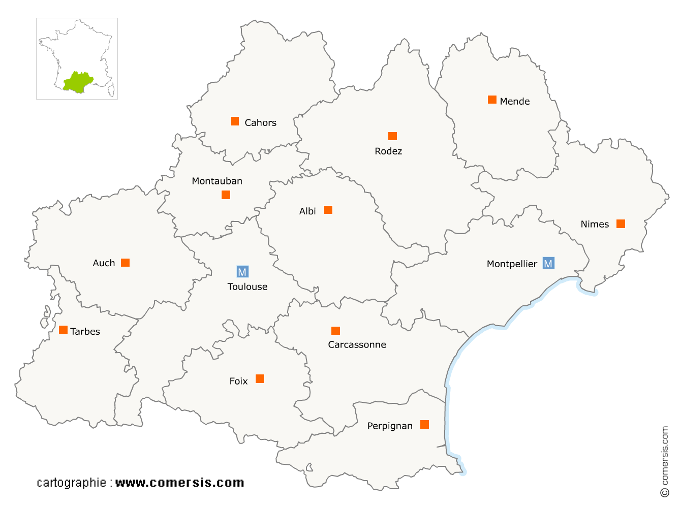
Vous recherchez un exploitant forestier en Occitanie ?
La région Occitanie représente 8% des exploitations forestières de France.
C'est le département du Tarn qui compte le plus d'exploitations forestières en Occitanie.
C'est le département du Tarn qui compte le plus d'exploitations forestières en Occitanie.
Exploitation forestière et sylviculture en Haute-Garonne (31)
Secteur de Salies-du-Salat
Indice d'implantation
| Commune | Nb Pro | Habitants | Distance | |
|---|---|---|---|---|
| Salies-du-Salat - 31260 | 1 | 1818 | 0,0 | km |
| Mane - 31260 | 5 | 990 | 2,5 | km |
| Cassagne - 31260 | 1 | 636 | 3,2 | km |
| His - 31260 | 1 | 227 | 4,3 | km |
| Lestelle-de-Saint-Martory - 31360 | 3 | 453 | 4,3 | km |
| Auzas - 31360 | 1 | 208 | 9,5 | km |
| Urau - 31260 | 1 | 134 | 9,8 | km |
| Saint-Médard - 31360 | 1 | 215 | 10,3 | km |
| Sepx - 31360 | 1 | 217 | 11,2 | km |
| Soueich - 31160 | 1 | 553 | 16,0 | km |
| Aspet - 31160 | 2 | 961 | 16,2 | km |
| Encausse-les-Thermes - 31160 | 1 | 692 | 18,9 | km |
| Sengouagnet - 31160 | 1 | 214 | 19,2 | km |
| Cazaunous - 31160 | 1 | 65 | 22,6 | km |
| Montesquieu-Volvestre - 31310 | 2 | 3205 | 24,8 | km |
Secteur de Saint-Gaudens
Indice d'implantation
| Commune | Nb Pro | Habitants | Distance | |
|---|---|---|---|---|
| Saint-Gaudens - 31800 | 8 | 11241 | 0,0 | km |
| Miramont-de-Comminges - 31800 | 1 | 778 | 2,4 | km |
| Labarthe-Rivière - 31800 | 1 | 1355 | 5,3 | km |
| Bordes-de-Rivière - 31210 | 1 | 497 | 7,2 | km |
| Ardiège - 31210 | 1 | 362 | 7,9 | km |
| Lalouret-Laffiteau - 31800 | 1 | 138 | 8,7 | km |
| Barbazan - 31510 | 1 | 448 | 11,6 | km |
| Montréjeau - 31210 | 1 | 2870 | 12,8 | km |
| Saint-Élix-Séglan - 31420 | 1 | 45 | 14,2 | km |
| Cuguron - 31210 | 1 | 193 | 14,7 | km |
| Esténos - 31440 | 2 | 185 | 19,4 | km |
| Eoux - 31420 | 1 | 120 | 22,5 | km |
| Marignac - 31440 | 1 | 486 | 22,5 | km |
| Bagnères-de-Luchon - 31110 | 1 | 2533 | 36,9 | km |
Secteur d'Auterive
Indice d'implantation
| Commune | Nb Pro | Habitants | Distance | |
|---|---|---|---|---|
| Auterive - 31190 | 1 | 9252 | 0,0 | km |
| Miremont - 31190 | 2 | 2278 | 5,5 | km |
| Cintegabelle - 31550 | 1 | 2768 | 6,3 | km |
| Lagardelle-sur-Lèze - 31870 | 1 | 2648 | 9,8 | km |
| Latrape - 31310 | 1 | 340 | 19,7 | km |
Secteur de Revel
Indice d'implantation
| Commune | Nb Pro | Habitants | Distance | |
|---|---|---|---|---|
| Revel - 31250 | 0 | 9364 | 0,0 | km |
| Sorèze - 81540 | 2 | 2715 | 4,9 | km |
| Belleserre - 81540 | 2 | 167 | 5,5 | km |
| Blan - 81700 | 1 | 1167 | 7,5 | km |
| Saint-Félix-Lauragais - 31540 | 1 | 1300 | 9,4 | km |
Secteur de Toulouse
Indice d'implantation
| Commune | Nb Pro | Habitants | Distance | |
|---|---|---|---|---|
| Toulouse - 31000 | 2 | 458298 | 0,0 | km |
| l'Union - 31240 | 1 | 11731 | 7,0 | km |
| Launaguet - 31140 | 1 | 7817 | 8,4 | km |
| Cornebarrieu - 31700 | 1 | 5930 | 11,5 | km |
| Gratentour - 31150 | 1 | 3535 | 13,7 | km |
Secteur de Grenade
Indice d'implantation
| Commune | Nb Pro | Habitants | Distance | |
|---|---|---|---|---|
| Grenade - 31330 | 0 | 8430 | 0,0 | km |
| Daux - 31700 | 1 | 2240 | 8,9 | km |
| Saint-Sauveur - 31790 | 1 | 1789 | 8,9 | km |
| le Castéra - 31530 | 1 | 833 | 16,8 | km |
| Cox - 31480 | 1 | 343 | 20,2 | km |
Secteur de Muret
Indice d'implantation
| Commune | Nb Pro | Habitants | Distance | |
|---|---|---|---|---|
| Muret - 31600 | 0 | 24725 | 0,0 | km |
| Eaunes - 31600 | 1 | 5782 | 5,1 | km |
| Marquefave - 31390 | 1 | 1008 | 17,3 | km |
Secteur de Ramonville-Saint-Agne
Indice d'implantation
| Commune | Nb Pro | Habitants | Distance | |
|---|---|---|---|---|
| Ramonville-Saint-Agne - 31520 | 1 | 13475 | 0,0 | km |
Exploitation forestière et sylviculture dans le Gers (32)
Secteur d'Auch
Indice d'implantation
| Commune | Nb Pro | Habitants | Distance | |
|---|---|---|---|---|
| Auch - 32000 | 0 | 21962 | 0,0 | km |
| Peyrusse-Massas - 32360 | 1 | 100 | 10,8 | km |
| l'Isle-de-Noé - 32300 | 2 | 531 | 15,5 | km |
| Miélan - 32170 | 1 | 1219 | 33,1 | km |
| Troncens - 32230 | 1 | 184 | 36,4 | km |
| Marciac - 32230 | 1 | 1252 | 36,9 | km |
| Couloumé-Mondebat - 32160 | 1 | 195 | 39,9 | km |
| Plaisance - 32160 | 1 | 1499 | 43,9 | km |
Secteur de Condom
Indice d'implantation
| Commune | Nb Pro | Habitants | Distance | |
|---|---|---|---|---|
| Condom - 32100 | 0 | 7003 | 0,0 | km |
| Ligardes - 32480 | 1 | 212 | 12,8 | km |
| Gondrin - 32330 | 1 | 1136 | 13,3 | km |
| Castelnau-d'Auzan - 32440 | 2 | 1259 | 22,8 | km |
| Eauze - 32800 | 2 | 3877 | 24,3 | km |
| Cazaubon - 32150 | 1 | 1709 | 35,4 | km |
Secteur d'Isle-Jourdain
Indice d'implantation
| Commune | Nb Pro | Habitants | Distance | |
|---|---|---|---|---|
| l'Isle-Jourdain - 32600 | 0 | 8012 | 0,0 | km |
| Pujaudran - 32600 | 1 | 1405 | 6,1 | km |
| Lias - 32600 | 1 | 533 | 7,2 | km |
Secteur de Fleurance
Indice d'implantation
| Commune | Nb Pro | Habitants | Distance | |
|---|---|---|---|---|
| Fleurance - 32500 | 0 | 6280 | 0,0 | km |
| Sempesserre - 32700 | 1 | 318 | 18,5 | km |
Exploitation forestière et sylviculture en Lozère (48)
Secteur de Mende
Indice d'implantation
| Commune | Nb Pro | Habitants | Distance | |
|---|---|---|---|---|
| Mende - 48000 | 11 | 11679 | 0,0 | km |
| Saint-Bauzile - 48000 | 2 | 666 | 4,1 | km |
| Badaroux - 48000 | 1 | 958 | 4,5 | km |
| Balsièges - 48000 | 1 | 535 | 5,4 | km |
| Chanac - 48230 | 3 | 1462 | 13,7 | km |
| Ispagnac - 48320 | 1 | 871 | 16,8 | km |
| Marvejols - 48100 | 3 | 4907 | 17,0 | km |
| le Bleymard - 48190 | 1 | 377 | 19,1 | km |
| le Monastier-Pin-Moriès - 48100 | 3 | 2115 | 19,3 | km |
| Florac - 48400 | 1 | 2130 | 22,8 | km |
| la Canourgue - 48500 | 1 | 2126 | 24,7 | km |
| Banassac - 48500 | 1 | 1036 | 25,5 | km |
| Saint-Germain-du-Teil - 48340 | 1 | 821 | 26,3 | km |
| Altier - 48800 | 1 | 208 | 29,2 | km |
| Vebron - 48400 | 1 | 194 | 31,7 | km |
| Cassagnas - 48400 | 1 | 116 | 33,8 | km |
| Villefort - 48800 | 1 | 604 | 35,8 | km |
| Langogne - 48300 | 1 | 2944 | 36,5 | km |
| le Pompidou - 48110 | 1 | 174 | 38,1 | km |
| Saint-André-de-Lancize - 48240 | 2 | 127 | 38,2 | km |
| Meyrueis - 48150 | 1 | 823 | 38,3 | km |
| Saint-Germain-de-Calberte - 48370 | 1 | 445 | 41,6 | km |
| Sainte-Croix-Vallée-Française - 48110 | 1 | 332 | 42,4 | km |
Secteur de Saint-Chély-d'Apcher
Indice d'implantation
| Commune | Nb Pro | Habitants | Distance | |
|---|---|---|---|---|
| Saint-Chély-d'Apcher - 48200 | 2 | 4162 | 0,0 | km |
| Rimeize - 48200 | 1 | 584 | 5,6 | km |
| la Fage-Saint-Julien - 48200 | 1 | 290 | 6,9 | km |
| le Malzieu-Ville - 48140 | 5 | 749 | 7,0 | km |
| Blavignac - 48200 | 1 | 292 | 9,0 | km |
| Saint-Alban-sur-Limagnole - 48120 | 1 | 1396 | 9,1 | km |
| Aumont-Aubrac - 48130 | 3 | 1094 | 9,1 | km |
| Albaret-Sainte-Marie - 48200 | 1 | 567 | 9,5 | km |
| le Malzieu-Forain - 48140 | 1 | 458 | 10,3 | km |
| Fontans - 48700 | 2 | 214 | 11,4 | km |
| Lajo - 48120 | 2 | 105 | 12,1 | km |
| Fournels - 48310 | 1 | 371 | 12,7 | km |
| Serverette - 48700 | 1 | 269 | 14,1 | km |
| Albaret-le-Comtal - 48310 | 1 | 184 | 14,2 | km |
| le Buisson - 48100 | 2 | 241 | 19,8 | km |
| Nasbinals - 48260 | 1 | 509 | 24,2 | km |
| Saint-Bonnet-de-Montauroux - 48600 | 1 | 108 | 35,0 | km |
Exploitation forestière et sylviculture dans les Hautes-Pyrénées (65)
Secteur de Bagnères-de-Bigorre
Indice d'implantation
| Commune | Nb Pro | Habitants | Distance | |
|---|---|---|---|---|
| Bagnères-de-Bigorre - 65200 | 0 | 7633 | 0,0 | km |
| Campan - 65710 | 1 | 1345 | 5,8 | km |
| Capvern - 65130 | 1 | 1293 | 13,8 | km |
| Avezac-Prat-Lahitte - 65130 | 1 | 564 | 15,2 | km |
| Burg - 65190 | 1 | 270 | 19,9 | km |
| Lannemezan - 65300 | 3 | 5940 | 19,9 | km |
| Argelès-Gazost - 65400 | 1 | 3048 | 21,4 | km |
| Tuzaguet - 65150 | 3 | 457 | 23,5 | km |
| Clarens - 65300 | 1 | 501 | 24,1 | km |
| Arreau - 65240 | 1 | 819 | 24,8 | km |
| Tajan - 65300 | 1 | 151 | 28,7 | km |
| Loures-Barousse - 65370 | 2 | 611 | 37,2 | km |
| Bertren - 65370 | 1 | 228 | 38,8 | km |
| Saléchan - 65370 | 1 | 214 | 40,9 | km |
Secteur de Tarbes
Indice d'implantation
| Commune | Nb Pro | Habitants | Distance | |
|---|---|---|---|---|
| Tarbes - 65000 | 1 | 41062 | 0,0 | km |
| Momères - 65360 | 1 | 715 | 6,5 | km |
| Dours - 65350 | 1 | 228 | 8,9 | km |
| Ossun - 65380 | 1 | 2314 | 9,6 | km |
| Siarrouy - 65500 | 1 | 429 | 9,9 | km |
| Aubarède - 65350 | 1 | 279 | 14,3 | km |
| Rabastens-de-Bigorre - 65140 | 1 | 1478 | 18,2 | km |
| Juncalas - 65100 | 1 | 178 | 20,9 | km |
| Lugagnan - 65100 | 1 | 153 | 21,1 | km |
| Ousté - 65100 | 1 | 37 | 21,7 | km |
| Lalanne-Trie - 65220 | 1 | 113 | 23,3 | km |
| Sariac-Magnoac - 65230 | 1 | 151 | 39,2 | km |
Exploitation forestière et sylviculture dans le Tarn (81)
Secteur de Castres
Indice d'implantation
| Commune | Nb Pro | Habitants | Distance | |
|---|---|---|---|---|
| Castres - 81100 | 5 | 41636 | 0,0 | km |
| Lagarrigue - 81090 | 1 | 1806 | 4,4 | km |
| Viviers-lès-Montagnes - 81290 | 1 | 1931 | 7,7 | km |
| Labruguière - 81290 | 9 | 6442 | 7,8 | km |
| Noailhac - 81490 | 1 | 855 | 9,7 | km |
| Sémalens - 81570 | 1 | 2023 | 10,6 | km |
| Lacrouzette - 81210 | 1 | 1734 | 10,8 | km |
| Caucalières - 81200 | 1 | 304 | 11,1 | km |
| Boissezon - 81490 | 1 | 404 | 11,7 | km |
| Escoussens - 81290 | 1 | 635 | 12,1 | km |
| Saint-Salvy-de-la-Balme - 81490 | 3 | 541 | 12,9 | km |
| Aiguefonde - 81200 | 3 | 2574 | 13,9 | km |
| Dourgne - 81110 | 1 | 1310 | 16,0 | km |
| Aussillon - 81200 | 11 | 6148 | 16,3 | km |
| Cambounès - 81260 | 1 | 344 | 16,4 | km |
| Mazamet - 81200 | 7 | 10118 | 16,7 | km |
| Pont-de-Larn - 81660 | 6 | 2886 | 17,6 | km |
| Vabre - 81330 | 2 | 803 | 17,7 | km |
| Bout-du-Pont-de-Larn - 81660 | 1 | 1225 | 18,0 | km |
| Puylaurens - 81700 | 2 | 3255 | 18,9 | km |
| Brassac - 81260 | 1 | 1331 | 19,5 | km |
| Castelnau-de-Brassac - 81260 | 6 | 933 | 22,9 | km |
| Saint-Pierre-de-Trivisy - 81330 | 1 | 634 | 23,2 | km |
| Saint-Amans-Valtoret - 81240 | 4 | 931 | 24,4 | km |
| Saint-Amans-Soult - 81240 | 1 | 1646 | 24,8 | km |
| Anglès - 81260 | 1 | 525 | 26,3 | km |
| Berlats - 81260 | 1 | 103 | 28,0 | km |
| Sauveterre - 81240 | 1 | 183 | 29,3 | km |
| Lamontélarié - 81260 | 1 | 70 | 29,3 | km |
| Lacabarède - 81240 | 1 | 295 | 31,5 | km |
| Gijounet - 81530 | 2 | 119 | 32,4 | km |
| Labastide-Rouairoux - 81270 | 1 | 1418 | 35,4 | km |
| la Salvetat-sur-Agout - 34330 | 2 | 1113 | 37,3 | km |
| Lacaune - 81230 | 2 | 2536 | 37,9 | km |
| Fraisse-sur-Agout - 34330 | 1 | 343 | 44,9 | km |
Secteur de Gaillac
Indice d'implantation
| Commune | Nb Pro | Habitants | Distance | |
|---|---|---|---|---|
| Gaillac - 81600 | 0 | 14334 | 0,0 | km |
| Brens - 81600 | 1 | 2250 | 1,8 | km |
| Senouillac - 81600 | 1 | 1090 | 6,2 | km |
| Lisle-sur-Tarn - 81310 | 1 | 4440 | 8,8 | km |
| Castelnau-de-Montmiral - 81140 | 1 | 1029 | 9,6 | km |
| Sainte-Cécile-du-Cayrou - 81140 | 2 | 120 | 14,5 | km |
| Rabastens - 81800 | 1 | 5290 | 16,4 | km |
| Briatexte - 81390 | 1 | 2027 | 16,7 | km |
Secteur de Carmaux
Indice d'implantation
| Commune | Nb Pro | Habitants | Distance | |
|---|---|---|---|---|
| Carmaux - 81400 | 3 | 9688 | 0,0 | km |
| le Garric - 81450 | 1 | 1258 | 4,4 | km |
| Saint-Jean-de-Marcel - 81350 | 1 | 372 | 7,2 | km |
| Montauriol - 81190 | 1 | 46 | 13,8 | km |
Secteur d'Albi
Indice d'implantation
| Commune | Nb Pro | Habitants | Distance | |
|---|---|---|---|---|
| Albi - 81000 | 1 | 49342 | 0,0 | km |
| Saint-Juéry - 81160 | 1 | 6749 | 5,9 | km |
| Fréjairolles - 81990 | 1 | 1314 | 8,8 | km |
| Villefranche-d'Albigeois - 81430 | 1 | 1234 | 15,4 | km |
| Curvalle - 81250 | 1 | 408 | 29,4 | km |
Secteur de Lavaur
Indice d'implantation
| Commune | Nb Pro | Habitants | Distance | |
|---|---|---|---|---|
| Lavaur - 81500 | 0 | 10691 | 0,0 | km |
| Labastide-Saint-Georges - 81500 | 1 | 1908 | 1,5 | km |
Exploitation forestière et sylviculture dans l'Hérault (34)
Secteur de Bédarieux
Indice d'implantation
| Commune | Nb Pro | Habitants | Distance | |
|---|---|---|---|---|
| Bédarieux - 34600 | 2 | 6241 | 0,0 | km |
| Lamalou-les-Bains - 34240 | 2 | 2586 | 6,6 | km |
| les Aires - 34600 | 1 | 596 | 7,3 | km |
| Saint-Gervais-sur-Mare - 34610 | 1 | 866 | 10,3 | km |
| Colombières-sur-Orb - 34390 | 1 | 471 | 13,0 | km |
| Causses-et-Veyran - 34490 | 1 | 624 | 16,8 | km |
| Olargues - 34390 | 1 | 658 | 20,9 | km |
| Riols - 34220 | 2 | 763 | 32,1 | km |
| Saint-Pons-de-Thomières - 34220 | 1 | 1993 | 35,0 | km |
| Courniou - 34220 | 2 | 606 | 39,4 | km |
| Verreries-de-Moussans - 34220 | 2 | 92 | 42,4 | km |
Secteur de Montpellier
Indice d'implantation
| Commune | Nb Pro | Habitants | Distance | |
|---|---|---|---|---|
| Montpellier - 34000 | 7 | 272084 | 0,0 | km |
| Lattes - 34970 | 1 | 15748 | 5,1 | km |
| Pignan - 34570 | 1 | 6512 | 9,2 | km |
| Cournonterral - 34660 | 1 | 5826 | 13,6 | km |
Secteur d'Agde
Indice d'implantation
| Commune | Nb Pro | Habitants | Distance | |
|---|---|---|---|---|
| Agde - 34300 | 0 | 25253 | 0,0 | km |
| Bessan - 34550 | 1 | 4703 | 6,4 | km |
| Castelnau-de-Guers - 34120 | 1 | 1149 | 13,8 | km |
| Montagnac - 34530 | 1 | 3907 | 18,6 | km |
| Saint-Pons-de-Mauchiens - 34230 | 3 | 662 | 22,5 | km |
Secteur de Béziers
Indice d'implantation
| Commune | Nb Pro | Habitants | Distance | |
|---|---|---|---|---|
| Béziers - 34500 | 2 | 74811 | 0,0 | km |
| Sauvian - 34410 | 1 | 4756 | 6,6 | km |
| Sérignan - 34410 | 1 | 7054 | 8,6 | km |
| Abeilhan - 34290 | 1 | 1567 | 13,2 | km |
Secteur de Saint-Gély-du-Fesc
Indice d'implantation
| Commune | Nb Pro | Habitants | Distance | |
|---|---|---|---|---|
| Saint-Gély-du-Fesc - 34980 | 0 | 9423 | 0,0 | km |
| Saint-Clément-de-Rivière - 34980 | 1 | 4807 | 3,8 | km |
| Saint-Mathieu-de-Tréviers - 34270 | 1 | 4667 | 9,5 | km |
| la Boissière - 34150 | 1 | 964 | 13,3 | km |
| Laroque - 34190 | 2 | 1573 | 26,3 | km |
Secteur de Clermont-l'Hérault
Indice d'implantation
| Commune | Nb Pro | Habitants | Distance | |
|---|---|---|---|---|
| Clermont-l'Hérault - 34800 | 1 | 8322 | 0,0 | km |
| Lacoste - 34800 | 1 | 316 | 2,2 | km |
| Mérifons - 34800 | 1 | 47 | 10,8 | km |
Secteur de Mauguio
Indice d'implantation
| Commune | Nb Pro | Habitants | Distance | |
|---|---|---|---|---|
| Mauguio - 34130 | 3 | 16659 | 0,0 | km |
Secteur de Sète
Indice d'implantation
| Commune | Nb Pro | Habitants | Distance | |
|---|---|---|---|---|
| Sète - 34200 | 1 | 44270 | 0,0 | km |
| Montbazin - 34560 | 1 | 2937 | 12,0 | km |
Exploitation forestière et sylviculture dans les Pyrénées-Orientales (66)
Secteur de Céret
Indice d'implantation
| Commune | Nb Pro | Habitants | Distance | |
|---|---|---|---|---|
| Céret - 66400 | 3 | 7663 | 0,0 | km |
| Vivès - 66490 | 1 | 174 | 4,7 | km |
| Maureillas-las-Illas - 66480 | 3 | 2673 | 4,8 | km |
| le Boulou - 66160 | 2 | 5547 | 7,7 | km |
| Arles-sur-Tech - 66150 | 3 | 2687 | 10,1 | km |
| Montferrer - 66150 | 1 | 188 | 15,9 | km |
| Saint-Laurent-de-Cerdans - 66260 | 2 | 1173 | 16,1 | km |
| Rigarda - 66320 | 1 | 632 | 23,4 | km |
| Prats-de-Mollo-la-Preste - 66230 | 1 | 1075 | 24,0 | km |
Secteur de Perpignan
Indice d'implantation
| Commune | Nb Pro | Habitants | Distance | |
|---|---|---|---|---|
| Perpignan - 66000 | 2 | 120959 | 0,0 | km |
| Baho - 66540 | 1 | 3203 | 5,7 | km |
| Villeneuve-de-la-Raho - 66180 | 1 | 3828 | 7,0 | km |
| Sainte-Marie - 66470 | 1 | 4725 | 10,6 | km |
| Saint-Hippolyte - 66510 | 1 | 2836 | 11,3 | km |
| Saint-Féliu-d'Amont - 66170 | 1 | 985 | 14,1 | km |
| Ille-sur-Têt - 66130 | 1 | 5405 | 22,4 | km |
| Saint-Paul-de-Fenouillet - 66220 | 2 | 1872 | 34,2 | km |
Secteur de Pia
Indice d'implantation
| Commune | Nb Pro | Habitants | Distance | |
|---|---|---|---|---|
| Pia - 66380 | 1 | 8284 | 0,0 | km |
Exploitation forestière et sylviculture dans le Tarn-et-Garonne (82)
Secteur de Castelsarrasin
Indice d'implantation
| Commune | Nb Pro | Habitants | Distance | |
|---|---|---|---|---|
| Castelsarrasin - 82100 | 0 | 13739 | 0,0 | km |
| Castelmayran - 82210 | 1 | 1162 | 5,6 | km |
| Moissac - 82200 | 3 | 12564 | 7,4 | km |
| Lafrançaise - 82130 | 2 | 2872 | 14,7 | km |
| Pommevic - 82400 | 1 | 606 | 15,6 | km |
| Montesquieu - 82200 | 1 | 773 | 17,8 | km |
| Saint-Nazaire-de-Valentane - 82190 | 1 | 344 | 21,8 | km |
| Golfech - 82400 | 1 | 955 | 22,0 | km |
| Cazes-Mondenard - 82110 | 1 | 1219 | 22,3 | km |
| Grayssas - 47270 | 1 | 131 | 23,2 | km |
| Lamagistère - 82360 | 1 | 1113 | 24,6 | km |
| Dunes - 82340 | 1 | 1222 | 27,3 | km |
| Roquecor - 82150 | 1 | 425 | 34,1 | km |
| Montaigu-de-Quercy - 82150 | 1 | 1370 | 34,3 | km |
Secteur de Caussade
Indice d'implantation
| Commune | Nb Pro | Habitants | Distance | |
|---|---|---|---|---|
| Caussade - 82300 | 0 | 6753 | 0,0 | km |
| Auty - 82220 | 1 | 140 | 6,3 | km |
| Septfonds - 82240 | 2 | 2160 | 6,7 | km |
| Réalville - 82440 | 2 | 1886 | 7,1 | km |
| Bioule - 82800 | 1 | 1094 | 8,1 | km |
| Mirabel - 82440 | 1 | 1013 | 9,7 | km |
| Montpezat-de-Quercy - 82270 | 1 | 1513 | 9,8 | km |
| Nègrepelisse - 82800 | 1 | 5439 | 9,9 | km |
| Albias - 82350 | 1 | 3182 | 10,6 | km |
| Bruniquel - 82800 | 1 | 614 | 16,0 | km |
Secteur de Montauban
Indice d'implantation
| Commune | Nb Pro | Habitants | Distance | |
|---|---|---|---|---|
| Montauban - 82000 | 3 | 57921 | 0,0 | km |
| Corbarieu - 82370 | 1 | 1657 | 8,0 | km |
| Albefeuille-Lagarde - 82290 | 1 | 611 | 9,4 | km |
| Montastruc - 82130 | 1 | 319 | 10,7 | km |
| l'Honor-de-Cos - 82130 | 1 | 1545 | 11,7 | km |
| Verlhac-Tescou - 82230 | 1 | 507 | 17,3 | km |
Secteur de Montech
Indice d'implantation
| Commune | Nb Pro | Habitants | Distance | |
|---|---|---|---|---|
| Montech - 82700 | 1 | 6072 | 0,0 | km |
| Finhan - 82700 | 2 | 1498 | 5,2 | km |
Exploitation forestière et sylviculture dans l'Ariège (09)
Secteur de Foix
Indice d'implantation
| Commune | Nb Pro | Habitants | Distance | |
|---|---|---|---|---|
| Foix - 09000 | 5 | 9731 | 0,0 | km |
| Ganac - 09000 | 1 | 693 | 3,9 | km |
| Loubières - 09000 | 2 | 300 | 5,5 | km |
| Saint-Jean-de-Verges - 09000 | 1 | 1181 | 5,9 | km |
| Saint-Paul-de-Jarrat - 09000 | 7 | 1245 | 6,6 | km |
| Baulou - 09000 | 1 | 164 | 8,5 | km |
| Mercus-Garrabet - 09400 | 1 | 1143 | 9,4 | km |
| Varilhes - 09120 | 1 | 3293 | 9,6 | km |
| Arignac - 09400 | 1 | 732 | 9,9 | km |
| Rabat-les-Trois-Seigneurs - 09400 | 1 | 341 | 12,4 | km |
| Tarascon-sur-Ariège - 09400 | 1 | 3340 | 12,5 | km |
| Coussa - 09120 | 1 | 232 | 12,9 | km |
| les Cabannes - 09310 | 1 | 342 | 20,5 | km |
Secteur de Lavelanet
Indice d'implantation
| Commune | Nb Pro | Habitants | Distance | |
|---|---|---|---|---|
| Lavelanet - 09300 | 2 | 6312 | 0,0 | km |
| Dreuilhe - 09300 | 1 | 358 | 2,1 | km |
| Bénaix - 09300 | 1 | 148 | 2,9 | km |
| Péreille - 09300 | 1 | 209 | 4,0 | km |
| Laroque-d'Olmes - 09600 | 1 | 2524 | 4,7 | km |
| Fougax-et-Barrineuf - 09300 | 2 | 453 | 6,6 | km |
| Montségur - 09300 | 1 | 133 | 6,9 | km |
| Bélesta - 09300 | 1 | 1086 | 7,5 | km |
| Carla-de-Roquefort - 09300 | 1 | 160 | 8,3 | km |
| Dun - 09600 | 1 | 545 | 11,5 | km |
| Besset - 09500 | 1 | 160 | 16,2 | km |
| Montaillou - 09110 | 1 | 24 | 16,5 | km |
| Ax-les-Thermes - 09110 | 1 | 1281 | 23,8 | km |
| Quérigut - 09460 | 1 | 141 | 32,9 | km |
Secteur de Saint-Girons
Indice d'implantation
| Commune | Nb Pro | Habitants | Distance | |
|---|---|---|---|---|
| Saint-Girons - 09200 | 0 | 6289 | 0,0 | km |
| Saint-Lizier - 09190 | 1 | 1434 | 1,9 | km |
| Lorp-Sentaraille - 09190 | 1 | 1350 | 5,7 | km |
| Caumont - 09160 | 1 | 306 | 6,9 | km |
| Rimont - 09420 | 1 | 550 | 11,2 | km |
| Prat-Bonrepaux - 09160 | 2 | 870 | 11,2 | km |
| Soueix-Rogalle - 09140 | 2 | 409 | 11,8 | km |
| Mérigon - 09230 | 1 | 116 | 12,2 | km |
| Mauvezin-de-Sainte-Croix - 09230 | 1 | 39 | 12,5 | km |
| Oust - 09140 | 1 | 545 | 13,6 | km |
| Illartein - 09800 | 1 | 78 | 15,4 | km |
| Camarade - 09290 | 1 | 182 | 16,2 | km |
| Montagagne - 09240 | 1 | 55 | 21,9 | km |
| la Bastide-de-Sérou - 09240 | 1 | 960 | 23,5 | km |
| Aigues-Juntes - 09240 | 1 | 53 | 27,9 | km |
Secteur de Pamiers
Indice d'implantation
| Commune | Nb Pro | Habitants | Distance | |
|---|---|---|---|---|
| Pamiers - 09100 | 4 | 15744 | 0,0 | km |
| Villeneuve-du-Paréage - 09100 | 1 | 761 | 4,8 | km |
| Montaut - 09700 | 1 | 701 | 8,5 | km |
| Unzent - 09100 | 1 | 125 | 9,7 | km |
| Mazères - 09270 | 1 | 3795 | 16,1 | km |
| Sainte-Suzanne - 09130 | 1 | 235 | 21,3 | km |
| Saint-Ybars - 09210 | 1 | 646 | 23,2 | km |
| Lézat-sur-Lèze - 09210 | 1 | 2373 | 28,1 | km |
Exploitation forestière et sylviculture dans l'Aude (11)
Secteur de Carcassonne
Indice d'implantation
| Commune | Nb Pro | Habitants | Distance | |
|---|---|---|---|---|
| Carcassonne - 11000 | 3 | 46724 | 0,0 | km |
| Villemoustaussou - 11620 | 1 | 4181 | 4,2 | km |
| Villegailhenc - 11600 | 4 | 1650 | 5,9 | km |
| Conques-sur-Orbiel - 11600 | 2 | 2439 | 7,3 | km |
| Villanière - 11600 | 1 | 163 | 14,0 | km |
| Villeneuve-Minervois - 11160 | 1 | 1059 | 14,4 | km |
| Montolieu - 11170 | 1 | 854 | 15,1 | km |
| Cuxac-Cabardès - 11390 | 3 | 908 | 18,0 | km |
| Miraval-Cabardes - 11380 | 1 | 37 | 18,5 | km |
| Caunes-Minervois - 11160 | 2 | 1672 | 19,0 | km |
| Villesiscle - 11150 | 1 | 369 | 20,5 | km |
| Saissac - 11310 | 1 | 922 | 21,5 | km |
| Puichéric - 11700 | 1 | 1141 | 22,5 | km |
| les Martys - 11390 | 1 | 269 | 22,5 | km |
| Cenne-Monestiés - 11170 | 1 | 395 | 22,8 | km |
Secteur de Limoux
Indice d'implantation
| Commune | Nb Pro | Habitants | Distance | |
|---|---|---|---|---|
| Limoux - 11300 | 0 | 10166 | 0,0 | km |
| Cournanel - 11300 | 1 | 649 | 2,7 | km |
| Cépie - 11300 | 1 | 659 | 6,2 | km |
| Belvèze-du-Razès - 11240 | 1 | 877 | 12,9 | km |
| Espéraza - 11260 | 2 | 2002 | 13,2 | km |
| Saint-Benoît - 11230 | 1 | 104 | 13,3 | km |
| Arques - 11190 | 2 | 240 | 16,9 | km |
| Saint-Just-et-le-Bézu - 11500 | 1 | 51 | 19,8 | km |
| Quillan - 11500 | 2 | 3434 | 20,1 | km |
| Belvis - 11340 | 1 | 160 | 25,5 | km |
| Axat - 11140 | 3 | 612 | 27,9 | km |
| Camurac - 11340 | 1 | 111 | 37,6 | km |
Secteur de Lézignan-Corbières
Indice d'implantation
| Commune | Nb Pro | Habitants | Distance | |
|---|---|---|---|---|
| Lézignan-Corbières - 11200 | 2 | 11223 | 0,0 | km |
| Montséret - 11200 | 1 | 546 | 11,6 | km |
| Davejean - 11330 | 1 | 116 | 29,6 | km |
Exploitation forestière et sylviculture dans l'Aveyron (12)
Secteur de Rodez
Indice d'implantation
| Commune | Nb Pro | Habitants | Distance | |
|---|---|---|---|---|
| Rodez - 12000 | 3 | 23741 | 0,0 | km |
| Olemps - 12510 | 1 | 3280 | 1,9 | km |
| Onet-le-Château - 12850 | 1 | 11604 | 4,8 | km |
| Luc-la-Primaube - 12450 | 1 | 5833 | 5,4 | km |
| Flavin - 12450 | 2 | 2307 | 7,6 | km |
| Salles-la-Source - 12330 | 2 | 2168 | 10,1 | km |
| Comps-la-Grand-Ville - 12120 | 1 | 576 | 13,6 | km |
| Montrozier - 12630 | 1 | 1518 | 15,2 | km |
| Pont-de-Salars - 12290 | 1 | 1646 | 15,2 | km |
| le Vibal - 12290 | 1 | 491 | 15,3 | km |
| Rodelle - 12340 | 1 | 1052 | 15,9 | km |
| Colombiès - 12240 | 1 | 927 | 18,7 | km |
| Laissac - 12310 | 1 | 2073 | 20,2 | km |
| Sébrazac - 12190 | 1 | 503 | 20,3 | km |
| Auriac-Lagast - 12120 | 1 | 233 | 23,1 | km |
| Camjac - 12800 | 3 | 578 | 24,6 | km |
| Auzits - 12390 | 1 | 859 | 25,9 | km |
| Saint-Côme-d'Olt - 12500 | 2 | 1329 | 26,5 | km |
| Sénergues - 12320 | 1 | 427 | 29,0 | km |
| le Cayrol - 12500 | 1 | 260 | 31,3 | km |
| Entraygues-sur-Truyère - 12140 | 1 | 1056 | 32,6 | km |
| Saint-Geniez-d'Olt - 12130 | 1 | 2139 | 34,3 | km |
| Laguiole - 12210 | 1 | 1229 | 42,9 | km |
Secteur de Saint-Affrique
Indice d'implantation
| Commune | Nb Pro | Habitants | Distance | |
|---|---|---|---|---|
| Saint-Affrique - 12400 | 2 | 8251 | 0,0 | km |
| les Costes-Gozon - 12400 | 1 | 175 | 9,3 | km |
| Tournemire - 12250 | 1 | 400 | 10,9 | km |
| Camarès - 12360 | 2 | 986 | 15,4 | km |
| Fayet - 12360 | 1 | 260 | 17,9 | km |
| Murasson - 12370 | 1 | 186 | 24,1 | km |
| Réquista - 12170 | 2 | 2016 | 29,1 | km |
Secteur de Villefranche-de-Rouergue
Indice d'implantation
| Commune | Nb Pro | Habitants | Distance | |
|---|---|---|---|---|
| Villefranche-de-Rouergue - 12200 | 0 | 11909 | 0,0 | km |
| la Bastide-l'Évêque - 12200 | 1 | 1638 | 8,2 | km |
| Martiel - 12200 | 1 | 1002 | 9,2 | km |
| Salles-Courbatiès - 12260 | 1 | 404 | 13,9 | km |
| Privezac - 12350 | 1 | 349 | 14,0 | km |
| Rieupeyroux - 12240 | 2 | 2020 | 17,0 | km |
| la Salvetat-Peyralès - 12440 | 1 | 983 | 19,8 | km |
| Galgan - 12220 | 1 | 357 | 20,5 | km |
| Tayrac - 12440 | 1 | 161 | 23,0 | km |
Secteur de Millau
Indice d'implantation
| Commune | Nb Pro | Habitants | Distance | |
|---|---|---|---|---|
| Millau - 12100 | 4 | 22205 | 0,0 | km |
| Sévérac-le-Château - 12150 | 1 | 4101 | 25,4 | km |
| Campagnac - 12560 | 1 | 460 | 35,4 | km |
Exploitation forestière et sylviculture dans le Gard (30)
Secteur d'Alès
Indice d'implantation
| Commune | Nb Pro | Habitants | Distance | |
|---|---|---|---|---|
| Alès - 30100 | 3 | 40711 | 0,0 | km |
| Saint-Martin-de-Valgalgues - 30520 | 1 | 4289 | 3,7 | km |
| Saint-Hilaire-de-Brethmas - 30560 | 1 | 4227 | 6,5 | km |
| Bagard - 30140 | 1 | 2541 | 6,6 | km |
| Générargues - 30140 | 1 | 707 | 9,3 | km |
| Vézénobres - 30360 | 1 | 1740 | 9,5 | km |
| Anduze - 30140 | 2 | 3377 | 11,1 | km |
| Saint-Florent-sur-Auzonnet - 30960 | 2 | 1221 | 13,0 | km |
| Brouzet-lès-Alès - 30580 | 2 | 633 | 13,3 | km |
| Saint-Jean-du-Gard - 30270 | 1 | 2706 | 15,8 | km |
| Portes - 30530 | 1 | 368 | 16,5 | km |
| Robiac-Rochessadoule - 30160 | 1 | 923 | 16,8 | km |
| Bessèges - 30160 | 1 | 3024 | 18,4 | km |
| Sainte-Croix-de-Caderle - 30460 | 1 | 121 | 18,6 | km |
| Chambon - 30450 | 1 | 298 | 20,1 | km |
| Gagnières - 30160 | 1 | 1160 | 20,4 | km |
| Lasalle - 30460 | 1 | 1144 | 20,4 | km |
| Monoblet - 30170 | 1 | 673 | 21,1 | km |
| Chamborigaud - 30530 | 1 | 813 | 21,4 | km |
| Sauve - 30610 | 2 | 1974 | 23,3 | km |
| Quissac - 30260 | 1 | 3116 | 25,3 | km |
| Saint-Hippolyte-du-Fort - 30170 | 3 | 3886 | 25,6 | km |
| Saint-André-de-Majencoules - 30570 | 1 | 623 | 34,4 | km |
| Valleraugue - 30570 | 2 | 1 | 35,5 | km |
| Avèze - 30120 | 1 | 1099 | 42,2 | km |
Secteur de Nîmes
Indice d'implantation
| Commune | Nb Pro | Habitants | Distance | |
|---|---|---|---|---|
| Nîmes - 30000 | 6 | 150564 | 0,0 | km |
| Manduel - 30129 | 1 | 6346 | 9,3 | km |
| Bernis - 30620 | 1 | 3264 | 10,1 | km |
| Montpezat - 30730 | 1 | 1039 | 16,5 | km |
| Saint-Gilles - 30800 | 3 | 13641 | 18,8 | km |
Secteur d'Uzès
Indice d'implantation
| Commune | Nb Pro | Habitants | Distance | |
|---|---|---|---|---|
| Uzès - 30700 | 1 | 8573 | 0,0 | km |
| Saint-Maximin - 30700 | 1 | 700 | 3,2 | km |
| Saint-Siffret - 30700 | 1 | 1053 | 3,7 | km |
| Saint-Victor-des-Oules - 30700 | 2 | 304 | 6,0 | km |
| Collorgues - 30190 | 2 | 550 | 10,4 | km |
| Castillon-du-Gard - 30210 | 1 | 1572 | 11,7 | km |
| Pouzilhac - 30210 | 1 | 636 | 13,2 | km |
Secteur de Beaucaire
Indice d'implantation
| Commune | Nb Pro | Habitants | Distance | |
|---|---|---|---|---|
| Beaucaire - 30300 | 3 | 16036 | 0,0 | km |
| Montfrin - 30490 | 1 | 3187 | 8,3 | km |
| Théziers - 30390 | 1 | 1103 | 10,4 | km |
| Domazan - 30390 | 2 | 919 | 13,4 | km |
Secteur de Bagnols-sur-Cèze
Indice d'implantation
| Commune | Nb Pro | Habitants | Distance | |
|---|---|---|---|---|
| Bagnols-sur-Cèze - 30200 | 1 | 18218 | 0,0 | km |
| Saint-Nazaire - 30200 | 1 | 1199 | 4,0 | km |
| Laudun-l'Ardoise - 30290 | 1 | 6034 | 7,0 | km |
| Cavillargues - 30330 | 1 | 809 | 9,4 | km |
| Cornillon - 30630 | 1 | 931 | 12,7 | km |
| Barjac - 30430 | 1 | 1564 | 27,1 | km |
Secteur de Vauvert
Indice d'implantation
| Commune | Nb Pro | Habitants | Distance | |
|---|---|---|---|---|
| Vauvert - 30600 | 1 | 11195 | 0,0 | km |
| Sommières - 30250 | 1 | 4536 | 18,1 | km |
Exploitation forestière et sylviculture dans le Lot (46)
Secteur de Cahors
Indice d'implantation
| Commune | Nb Pro | Habitants | Distance | |
|---|---|---|---|---|
| Cahors - 46000 | 0 | 19616 | 0,0 | km |
| Lamagdelaine - 46090 | 1 | 736 | 4,5 | km |
| Espère - 46090 | 1 | 993 | 8,9 | km |
| Concots - 46260 | 1 | 419 | 17,0 | km |
| Thédirac - 46150 | 1 | 317 | 19,7 | km |
| Tour-de-Faure - 46330 | 2 | 357 | 20,0 | km |
| Orniac - 46330 | 1 | 72 | 20,9 | km |
| Frayssinet-le-Gélat - 46250 | 2 | 353 | 26,5 | km |
| Cazals - 46250 | 1 | 613 | 27,9 | km |
| Marminiac - 46250 | 1 | 371 | 31,1 | km |
| Payrac - 46350 | 1 | 638 | 38,8 | km |
| Souillac - 46200 | 2 | 3491 | 49,8 | km |
Secteur de Figeac
Indice d'implantation
| Commune | Nb Pro | Habitants | Distance | |
|---|---|---|---|---|
| Figeac - 46100 | 0 | 9826 | 0,0 | km |
| Planioles - 46100 | 1 | 482 | 2,8 | km |
| Linac - 46270 | 1 | 226 | 9,0 | km |
| Assier - 46320 | 1 | 693 | 14,3 | km |
| Cajarc - 46160 | 1 | 1136 | 20,4 | km |
| Espédaillac - 46320 | 1 | 251 | 20,9 | km |
| Latouille-Lentillac - 46400 | 2 | 228 | 27,9 | km |
| Sousceyrac - 46190 | 1 | 1415 | 29,4 | km |
| Gramat - 46500 | 1 | 3596 | 30,7 | km |
| Autoire - 46400 | 1 | 343 | 31,9 | km |
| Montvalent - 46600 | 1 | 294 | 44,6 | km |